By SALINA POST
UPDATE 11:20 a.m. Monday: The Kansas Geological Survey has reported another minor earthquake, this time east of Assaria.
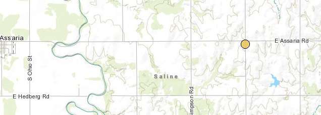
A 2.0 magnitude quake struck at 9:50 a.m. Monday. It was centered just south of the E. Assaria Road/S. Woodward Road intersection.
. . .
GYPSUM - After a quiet few days over Christmas, earthquake activity in southeastern Saline County has picked up again.
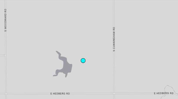
Late Sunday night, a 3.3 magnitude quake struck southwest of Gypsum. The quake hit ay 11:51 p.m. Sunday and was centered northwest of the E. Hedberg Road/S. Cunningham Road intersection, according to the U.S. Geological Survey.
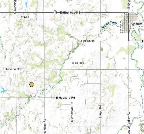
The Kansas Geological Survey then reported that a 2.1 magnitude earthquake struck at 12:56 a.m. Monday southwest of Gypsum. The quake was centered within the mile bounded by E. Hedberg Road and E. Assaria Road on the south and north and S. Niles Road and S. Cunningham Road on the east and west.
At 1:59 a.m. Monday, a 2.8 magnitude quake struck southwest of Gypsum, the Kansas Geological Survey reported. The quake was centered within the mile bounded by E. Hedberg Road and E. Assaria Road on the south and north and S. Whitmore Road and S. Niles Road on the east and west.
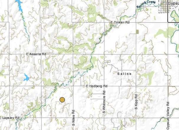
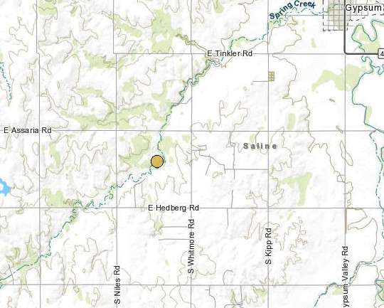
The Kansas Geological Survey then reported a 2.6 magnitude earthquake that struck at 3:58 a.m. Monday. It was centered west of S. Niles Road between E. Lapsley Road and E. Hedberg Road.
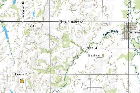
Then, at 8:02 a.m. Monday, a 2.0 magnitude quake struck, the Kansas Geological Survey reported. It was centered sout-southwest of the E. Assaria Road/S. Cunningham Road intersection.
READ: UPDATE: Seven small quakes strike SE Saline County, including a 3.9