Salina Post
As Sunday's heavy snow activity has ended in Salina, light snow is expected to continue throughout central Kansas
Original: Be vigilant: Activity of snow has arrived throughout central Kansas
According to the US National Weather Service, moderate to heavy snow has quickly come to an end, and only pockets of light snow are expected over the next couple of hours throughout the region.
Even with road conditions improving quickly, continue to exercise caution as roads could be slick through tonight.
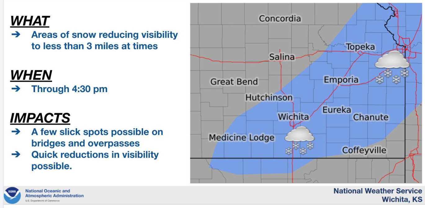
Areas of snow will remain through the late afternoon for locations generally along and just southeast of the Kansas Turnpike with little if any accumulation anticipated.
Some locations may see visibility reduced to less than 3 miles at times. There maybe a few slick spots on bridges and overpasses.
Salina is under a wind advisory until 6:00 pm Sunday.
The Emergency Accident Reporting Plan the Salina Police Department issued earlier on Sunday has been cancelled as well.
Monday's weather in Salina is expected to have a morning wind chill in the single digits to around zero. Afternoon highs are forecasted to be in the low 30s.
Stay updated with local weather on the US National Weather Service Wichita Kansas Facebook page.
Monitor local weather updates frequently in multiple ways by listening to the NOAA Weather Radio, checking local news and emergency notifications. You can also stay informed by following Saline County and the National Weather Service on social media.
For the latest forecast updates, visit the National Weather Service Wichita office at https://www.weather.gov/ict/. To check forecasts frequently, go to weather.gov.