Salina Post
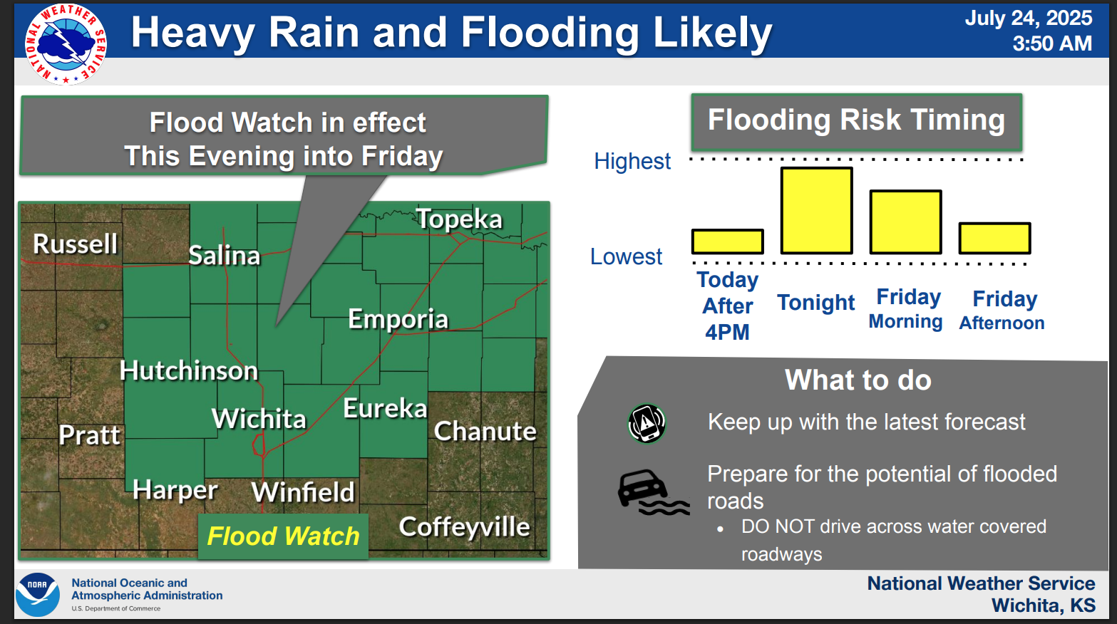
Salina will be under a 'Flood Watch' that takes into effect Thursday evening and into Friday, July 25.
According to the US National Weather Service, on Thursday Salina has been a issued a 'Flood Watch' for this evening. Reportedly, heavy rainfall is expected to develop into the afternoon and becoming more widespread overnight, with rainfall rates of 2 to 4 inches per hour possible.
Be aware on the roads as 'Flash Flooding' is likely, according to the US National Weather Service. The highest flooding risk period will occur from late this afternoon through Friday morning. If water begins rising near your location, immediately seek higher ground.
Saline County Emergency Management states that the main concerns are low water crossings and low-lying areas, where it's difficult to see the shoulder of the road. Drivers should exercise extreme caution, especially in areas known to flood frequently.
Saline County Emergency Management has listed the flood stages for certain areas:
Mulberry Creek near Salina: Forecasted to crest above flood stage at 24.75 feet overnight. Exercise extreme caution around waterways and low-lying areas.
Smoky Hill River near Mentor: Expected crest at 17.87 feet, nearing moderate flood levels. Avoid areas prone to flooding.
Smoky Hill River near New Cambria: Projected crest at 23.59 feet tonight, causing minor flooding. Monitor conditions and be prepared to move to higher ground.
Safety Recommendations:
- TURN AROUND, DON'T DROWN - never attempt to drive through flooded roads.
- Know your risk. Check if your home or workplace is in a flood-prone area.
- Have an emergency kit ready with essentials: water, food, medications, flashlight, batteries, and important documents.
- Stay out of floodwaters. They can hide debris, downed power lines, or dangerous currents.
- Avoid walking through moving water; as little as six inches can knock an adult off their feet.
- Secure outdoor items that could become airborne due to high winds.
- Avoid unnecessary travel during periods of severe weather, especially if snow reduces visibility.
- Monitor local weather updates frequently and have multiple ways to receive weather alerts, including NOAA Weather Radio, local news, and emergency notifications.
Everyone is encouraged to stay alert and monitor weather conditions closely.
Monitor local weather updates frequently in multiple ways by listening to the NOAA Weather Radio, checking local news and emergency notifications. You can also stay informed by following Saline County and the National Weather Service on social media.
For the latest forecast updates, visit the National Weather Service Wichita office at https://www.weather.gov/ict/. To check forecasts frequently, go to weather.gov.