By OLIVIA BERGMEIER
Salina Post
As ocean surface temperatures shift, it could change Kansas's winter normals throughout its core months.
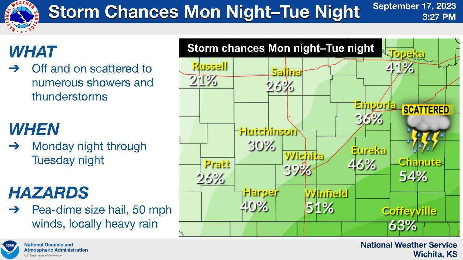
This week, the Wichita National Weather Service predicted that southern portions of Kansas will receive rain and possibly a few scattered thunderstorms.
NWS meteorologist Kevin Darmofal said as fall continues, the state may receive above-normal amounts of precipitation.
"It looks like there's a better-than-average chance that we may be seeing above-normal precipitation as we go through the fall and maybe the very beginning of meteorological winter (December 1)," Darmofal said.
As winter approaches, the impact of the El Niño weather pattern will begin to affect most of the United States, usually meaning below-normal precipitation and temperatures.
As El Niño shifts from La Niña, ocean surface temperatures change in the eastern tropical waters of the Pacific Ocean. El Niño is the warming of those surface waters.
Darmofal described this weather pattern as affecting the two jet streams that encompass most of the U.S., the Polar and Subtropical Jetstreams.
This change in the jetstreams typically looks like the Subtropical and Polar Jetstreams dipping south, bringing cold, dry air to the central portion of the U.S.
Occasionally, during El Niño phases, the Subtropical Jetstream can "stick" further north, bringing wetter air to Kansas and other midwestern states.
"If it does average a little colder and a little below normal, we can still have some pretty mild days, and we could get a big snowstorm in there, too," Darmofal said.