Salina Post
The US National Weather Service has issued a "Flood Watch" throughout parts of Central Kansas until Thursday afternoon.
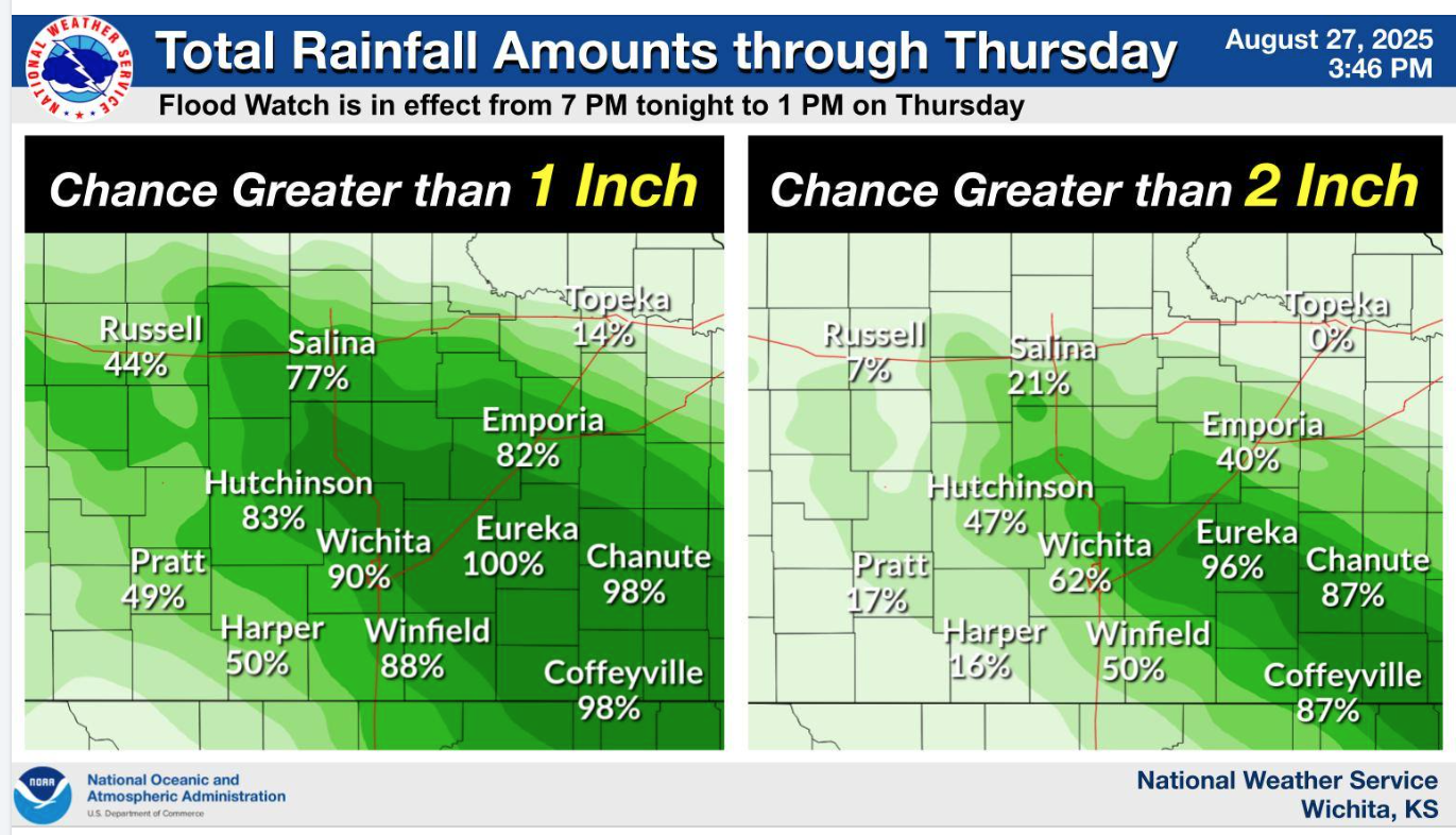
According to the US National Weather Service (Wichita, KS), many locations in Central Kansas are expected to see heavy rainfall tonight (Wednesday, August 27) and into Thursday morning, with some areas likely observing over 2 inches.
Salina is listed to have a 77% chance of rainfall over 1 inch and low chance for it to be over 2 inches.
Wichita is listed to have 62% chance, while Hutchinson a 47% chance of rainfall to be over 2 inches.
Saline County Emergency Management is informing county residents to prepare for at least two rounds of thunderstorms. The first round this Wednesday afternoon is expected to be less severe.
However, a stronger system is forecast to move in late tonight (Wednesday) through Thursday morning with a higher risk of heavy rainfall and localized flooding.
Safety tips by Saline County Emergency Management include:
- Never drive through a flooded intersection or roadway. Water is often deeper than it looks.
- Turn Around, Don’t Drown. If you encounter water over the road, find another route.
- Expect delays. Allow extra travel time, use main routes, and avoid shortcuts through low areas that may flood quickly.
- Secure your property. Clear gutters and drains today to help prevent water backup near homes.
Monitor local weather updates frequently in multiple ways by listening to the NOAA Weather Radio, checking local news and emergency notifications. You can also stay informed by following Saline County and the National Weather Service on social media.
For the latest forecast updates, visit the National Weather Service Wichita office at https://www.weather.gov/ict/. To check forecasts frequently, go to weather.gov.