Salina Post
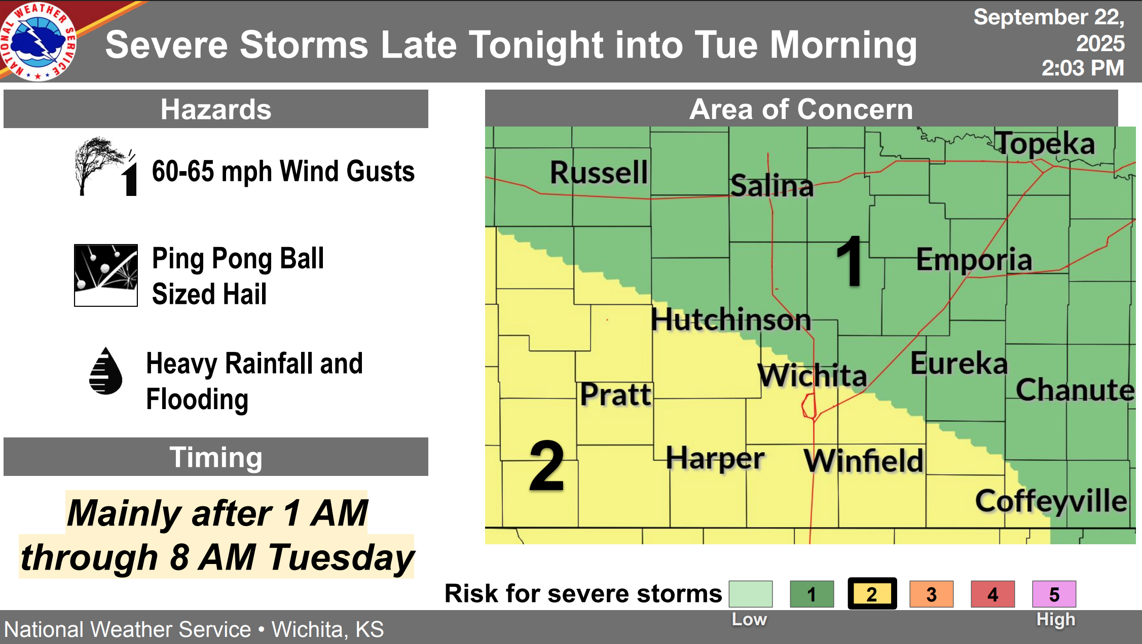
The US National Weather Service (NWS) in Wichita forecasts severe thunderstorms are expected to develop after midnight tonight and continue into Tuesday morning across Central Kansas.
According to NWS Wichita, these storms are likely to produce high rainfall rates, which may lead to flooding. Storms are expected to move in from the west after midnights, with most locations in Saline County after 3:00 am. The heaviest rainfall is likely between 4:00 am and noon Tuesday.
Saline County Emergency Management stated there is slightly lower confidence on how large hailstones may get, but the confidence is in the heavy rainfall and flooding potential has been increasing.
Safety recommendations:
- Have multiple ways to receive warnings: enable WEA alerts, keep a weather radio on, and set volume loud enough to wake you.
- Protect vehicles and property: park under sturdy cover and bring in loose outdoor items.
- Charge phones, flashlights, and keep spare batteries ready in case of power blips.
- Stay indoors and away from windows during hail and strong winds; bring pets inside.
- If driving, pull over safely if caught in hail or strong winds.
- Expect a slow Tuesday commute: never drive through water over the road, even if it looks shallow.
- Do not go around barricades—just 12–18 inches of moving water can carry away a vehicle. Turn Around, Don’t Drown.
Monitor local weather updates frequently in multiple ways by listening to the NOAA Weather Radio, checking local news and emergency notifications. You can also stay informed by following Saline County and the National Weather Service on social media.
For the latest forecast updates, visit the National Weather Service Wichita office at https://www.weather.gov/ict/. To check forecasts frequently, go to weather.gov.