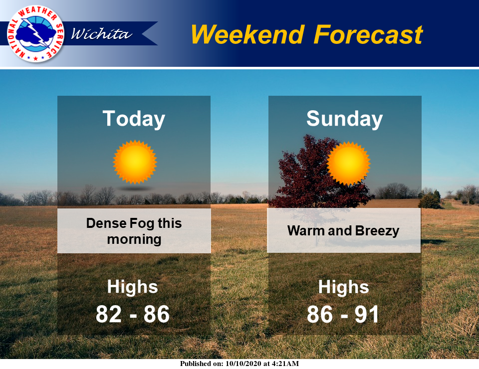
Warm weather will continue this weekend, with a touch of fog in some areas Saturday morning.
According to the National Weather Service (NWS) in Wichita, dense fog will affect parts of south central Kansas and all of southeast Kansas this morning.
Additionally, warm, above normal temperatures will prevail across the region for this weekend.
The unseasonably warm and dry air will combine with gusty south winds again on Sunday afternoon. This will result in very high grassland fire danger levels across portions of central Kansas, NWS noted.
Once we get through the weekend, temperatures will cool a bit. Here's the forecast for next week from NWS:
Today
Sunny, with a high near 85. Calm wind becoming southeast 5 to 8 mph in the morning.
Tonight
Clear, with a low around 60. Southeast wind around 8 mph.
Sunday
Sunny, with a high near 89. Breezy, with a south wind 10 to 15 mph increasing to 19 to 24 mph in the afternoon. Winds could gust as high as 33 mph.
Sunday Night
Isolated showers before 1am. Mostly clear, with a low around 49. Breezy, with a south wind 16 to 25 mph becoming north northwest after midnight. Winds could gust as high as 34 mph. Chance of precipitation is 10%.
Columbus Day
Sunny, with a high near 75. Northwest wind 10 to 15 mph becoming west southwest in the afternoon. Winds could gust as high as 22 mph.
Monday Night
Clear, with a low around 50.
Tuesday
Sunny, with a high near 76.
Tuesday Night
Clear, with a low around 48.
Wednesday
Sunny, with a high near 83.
Wednesday Night
Mostly clear, with a low around 48.
Thursday
Sunny, with a high near 69.
Thursday Night
Mostly clear, with a low around 40.
Friday
Mostly sunny, with a high near 66.