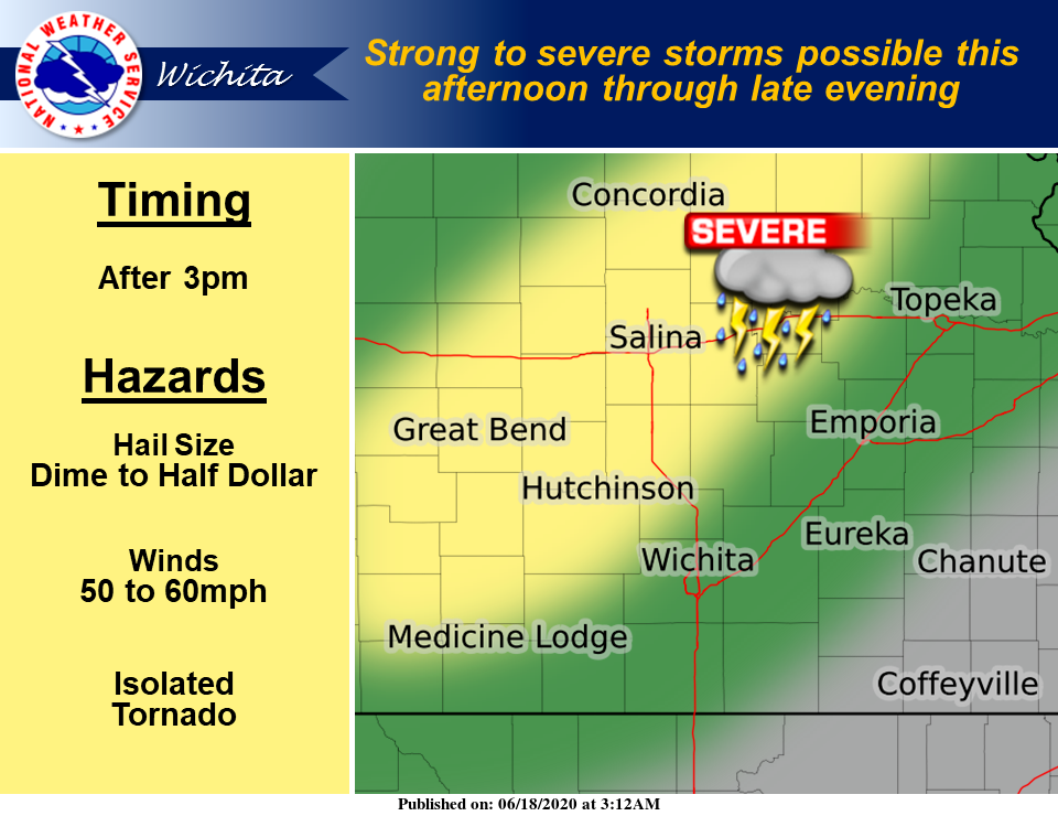
Strong to severe storms will be possible along a slow moving frontal boundary for this afternoon and tonight.
The National Weather Service in Wichita now says that large hail up to half dollar size, damaging winds up to 60 mph, and an isolated tornado are possible from the stronger storms.
. . .
Our first chance for rain in about a week is on the horizon.
A cold front will push southward into central Kansas on Thursday with strong to severe storms possible for the afternoon through the late evening hours, according to the National Weather Service (NWS) in Wichita.
Storms are first expected to develop after 3 p.m. Thursday over central Kansas, NWS noted.