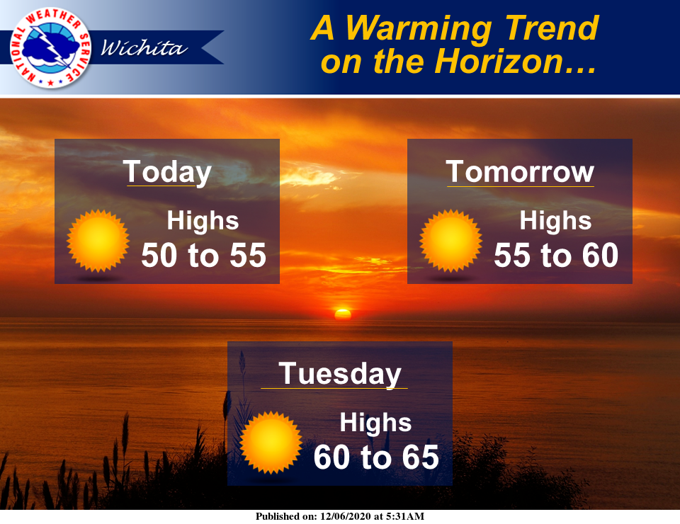
Expect clear skies and a warming trend to start the week.
According to the National Weather Service (NWS) in Wichita, temperatures will warm each day through mid-week, reaching the mid-60s by Tuesday and warmer still come Wednesday.
Following is the forecast for Salina from NWS.
Today
Sunny, with a high near 52. North wind 7 to 9 mph.
Tonight
Mostly clear, with a low around 28. Light and variable wind becoming west southwest around 6 mph after midnight.
Monday
Sunny, with a high near 58. Northwest wind 6 to 11 mph.
Monday Night
Clear, with a low around 29. West northwest wind around 6 mph.
Tuesday
Sunny, with a high near 60. West wind 5 to 7 mph.
Tuesday Night
Mostly clear, with a low around 34.
Wednesday
Sunny, with a high near 66.
Wednesday Night
Mostly clear, with a low around 33.
Thursday
Mostly sunny, with a high near 56.
Thursday Night
A slight chance of rain showers after midnight, mixing with snow after 4 a.m. Mostly cloudy, with a low around 33. Chance of precipitation is 20 percent.
Friday
A slight chance of rain and snow showers. Partly sunny, with a high near 47. Chance of precipitation is 20 percent.
Friday Night
Mostly cloudy, with a low around 27.
Saturday
Mostly sunny, with a high near 43.