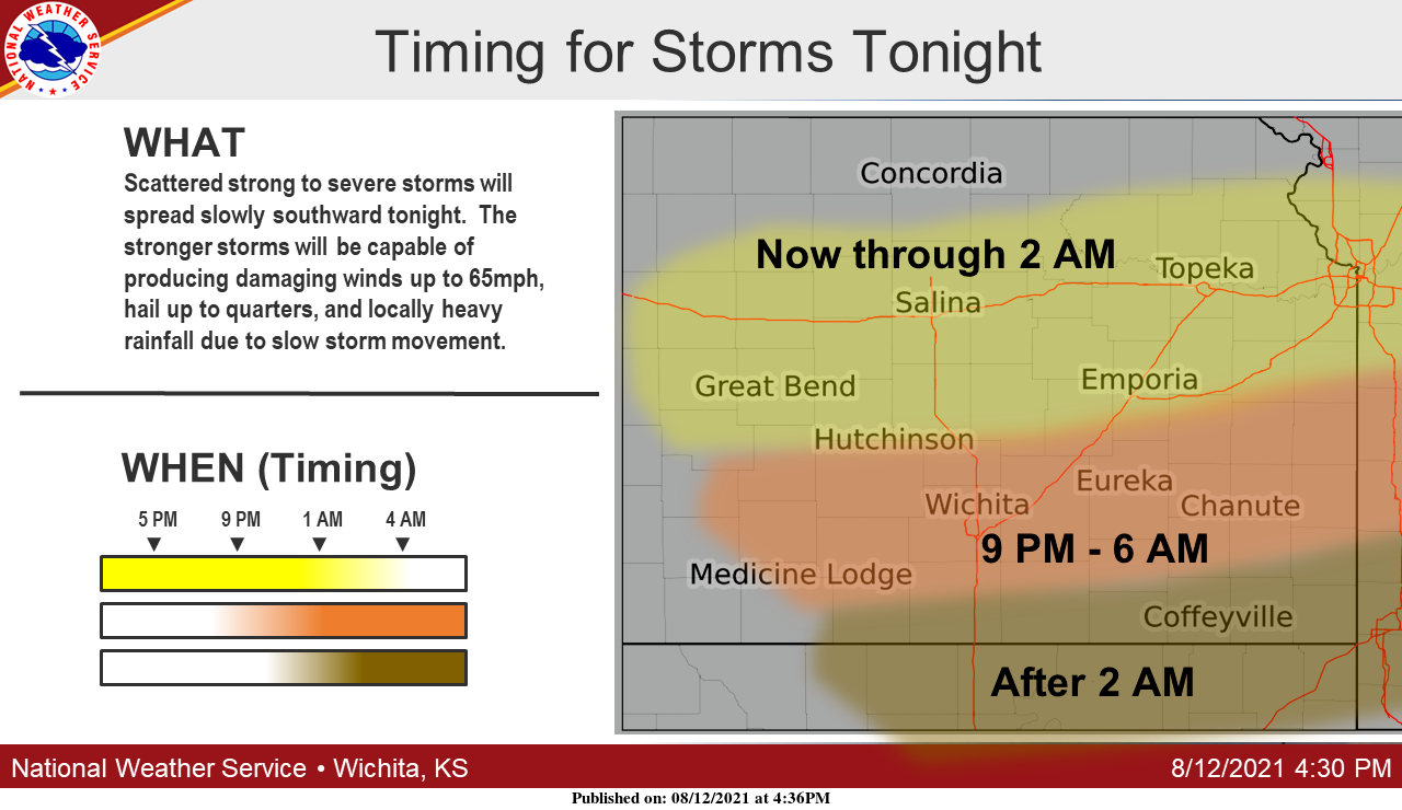
UPDATE 6:30 p.m. Thursday: Scattered strong to severe storms will move slowly southward across the region tonight.
. . .
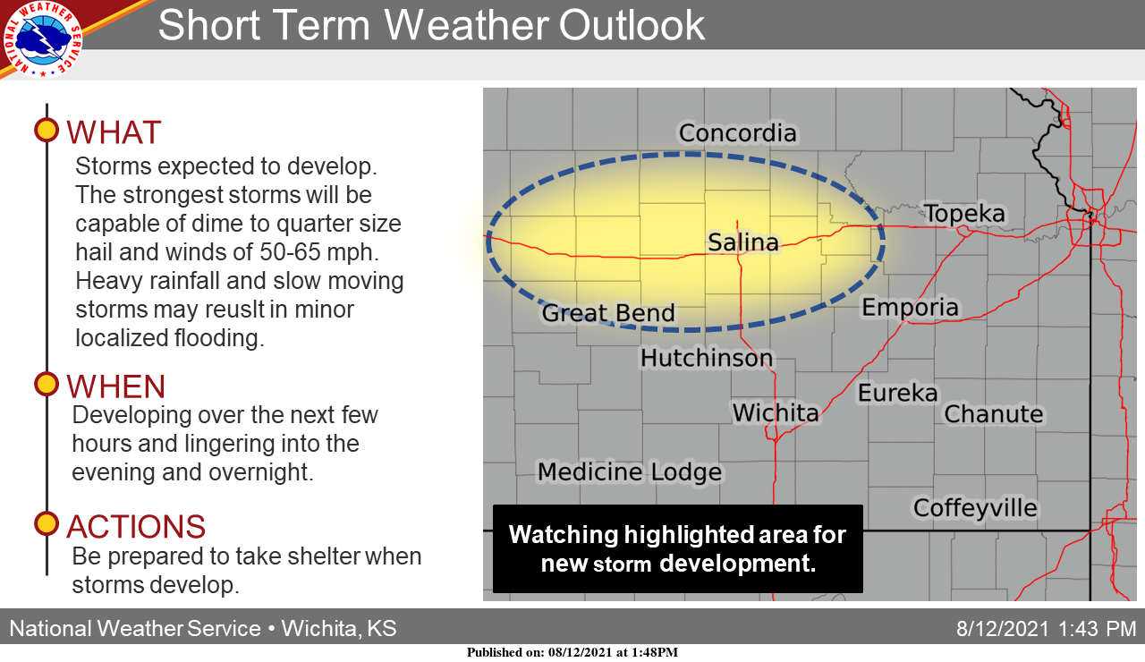
UPDATE 3:40 p.m. Thursday:
Strong to severe storms are expected to develop across central Kansas over the next few hours.
The strongest storms will be capable of winds of 50-65 mph and dime to quarter size hail. Minor localized flooding will be possible as well.
To see whether storms are headed your way, check out the radar on the Salina Post severe weather page. Click here.
. . .
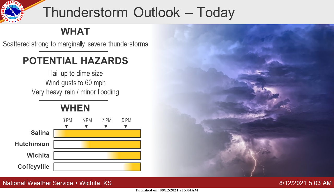
Scattered thunderstorms are expected to develop this afternoon across north-central Kansas, with the threat shifting south through tonight, possibly getting into southern Kansas by mid to late evening, according to the National Weather Service.
The strongest thunderstorms could produce gusty winds and small hail.