Winter weather advisories have been issued for counties in our area.
For road conditions, go to kandrive.org or call 5-1-1 or 1-866-511-KDOT (5368).
The National Weather Service (NWS) in Wichita has issued a winter weather advisory in effect from 3-11 a.m. Tuesday for the following counties in our area.
Marion County
McPherson County
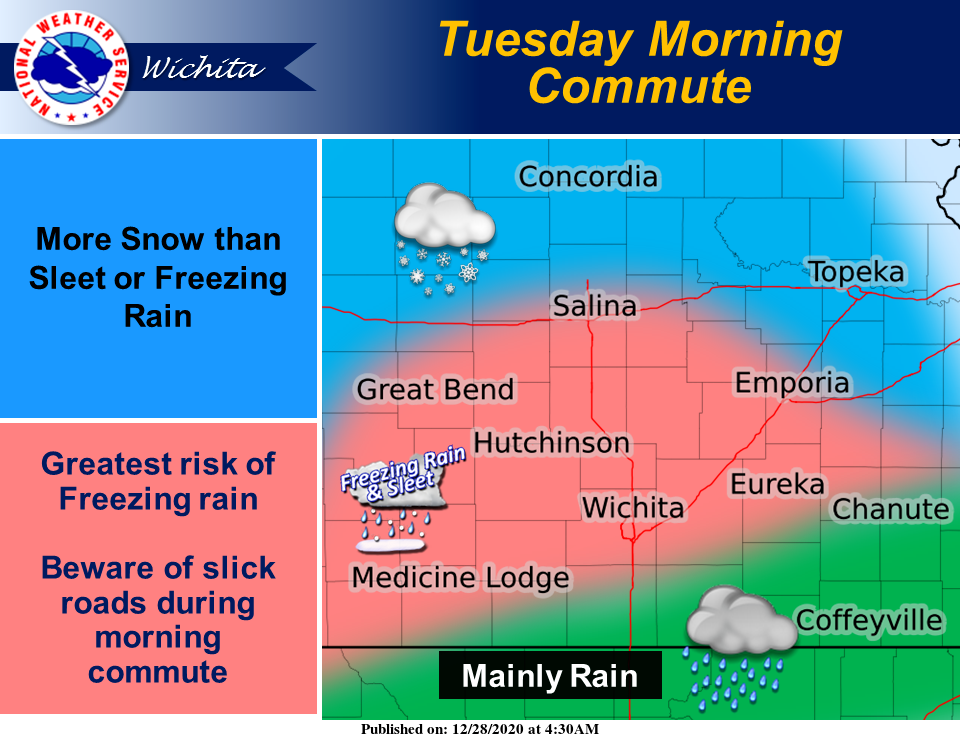
Mixed precipitation is expected. Total snow accumulations of up to one inch and ice accumulations of around one-tenth of an inch are forecast.
Plan on slippery road conditions. The hazardous conditions could impact the morning commute. Slow down and use caution while traveling.
Additionally, NWS in Wichita has issued a winter weather advisory in effect from 3 a.m.-1 p.m. Tuesday for the following counties in our area.
Ellsworth County
Lincoln County
Saline County
Mixed precipitation is expected. Total snow accumulations of up to one inch and ice accumulations of around one-tenth of an inch are forecast.
Plan on slippery road conditions. The hazardous conditions could impact the morning commute. Slow down and use caution while traveling.
NWS in Topeka has issued a winter weather advisory in effect from 6 a.m.-3 p.m. Tuesday for the following counties in our area.
Clay County
Ottawa County
Mixed precipitation is expected. Total snow accumulations of up to one inch and ice accumulations of around one-tenth of an inch are forecast.
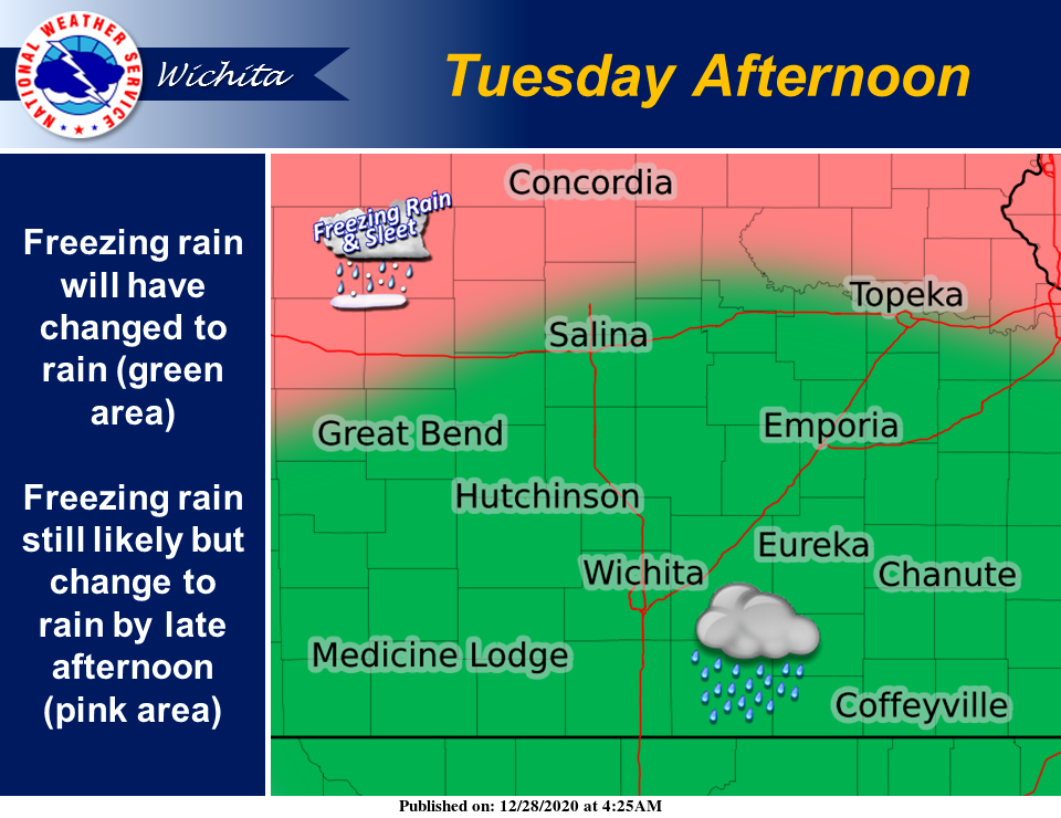
Snow is expected early Tuesday morning, with a transition to freezing rain and then rain from south to north during the course of the morning and early afternoon.
Plan on slippery road conditions. The hazardous conditions could impact the morning commute. Slow down and use caution while traveling.
Additionally, NWS in Topeka has issued a winter weather advisory in effect from 6 a.m. Tuesday to midnight Wednesday for the following counties in our area.
Cloud County
Republic County
Mixed precipitation is expected. Total snow accumulations of 1 to 3 inches and ice accumulations of around two-tenths of an inch are forecast.
Snow is expected early Tuesday morning, with a transition to freezing rain likely by the late morning. A wintry mixture may persist through the afternoon and into the evening hours on Tuesday.
Plan on slippery road conditions. The hazardous conditions could impact the morning commute. Slow down and use caution while traveling.
NWS in Topeka also has issued a winter weather advisory in effect from 6 a.m. to noon Tuesday for Dickinson County.
Snow is expected early Tuesday morning, with a transition to freezing rain and then rain from south to north during the course of the morning.
Plan on slippery road conditions. The hazardous conditions could impact the morning commute. Slow down and use caution while traveling.
NWS in Hastings, Neb., has issued a winter weather advisory in effect from midnight Tuesday to midnight Wednesday for the following counties in our area.
Jewell County
Mitchell County
Mixed precipitation is expected. Total snow accumulations of 1 to 4 inches and ice accumulations of up to one-tenth of an inch are forecast.
Plan on slippery road conditions. The hazardous conditions could impact the morning commute. Slow down and use caution while traveling.