
It looks to be a blustery the next couple of days over much of the area.
Very high fire danger will be in place areawide this afternoon due to gusty south winds and low humidity values. Outdoor burning is highly discouraged, according to the National Weather Service (NWS) in Wichita.
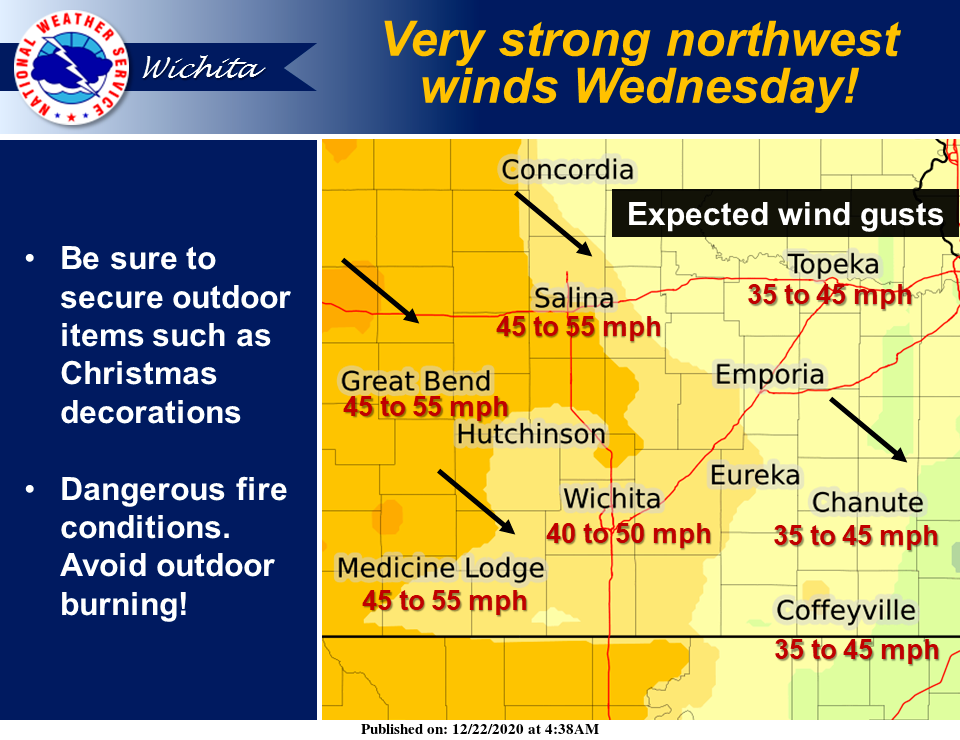
Winds will then shift with very strong northwest winds expected Wednesday afternoon with most locations seeing gusts in the 40 to 55 mph range, NWS noted. Be sure to secure outdoor items such as Christmas decorations. Strong winds will also cause dangerous fire conditions with outdoor burning highly discouraged.
Accordingly, NWS has issued wind advisories for counties in our area.
NWS in Wichita has issued a wind advisory in effect from noon today to 4 a.m. Wednesday that includes Marion County.
South winds around 30 mph with gusts 40 to 45 mph are forecast.
Gusty winds could blow around unsecured objects such as outdoor furniture and Christmas decorations. Use extra caution when driving, especially if operating a high profile vehicle.
Additionally, NWS in Topeka has issued a wind advisory in effect from noon Tuesday to 1 a.m. Wednesday that includes Dickinson County.
South winds 25 to 35 mph with gusts up to 45 mph are expected.
Gusty winds could blow around unsecured objects. Tree limbs could be blown down and a few power outages may result. Use extra caution when driving, especially if operating a high profile vehicle.
"The Kansas Department of Health and Environment recommends that you take preventative measures during this blowing dust event, such as staying indoors or wearing protective breathing masks if outside. High dust concentrations can cause respiratory problems, decrease lung activity, aggravate asthma, and lead to potential heart-related problems, especially with children, elderly, or those with pre-existing respiratory conditions," NWS Topeka noted.