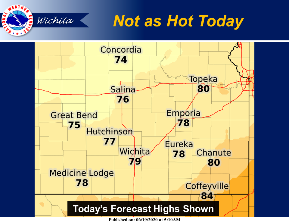
Temperatures will be noticeably less hot today thanks to mostly cloudy skies and scattered to numerous showers and thunderstorms around.
According to the National Weather Service (NWS) in Wichita, occasional thunderstorms will continue this morning across central and south-central Kansas, potentially lingering into the afternoon hours. At this time, the threat of severe weather looks low, however, wind gusts to 45 mph and nuisance flooding will be possible, NWS noted.
Additional thunderstorms are possible tonight areawide, but once again the threat of severe weather looks low.
Multiple rounds of thunderstorms are expected over the weekend, potentially continuing into next week. At this time, the greatest risk of severe weather looks to be Sunday afternoon through Sunday night, with lower confidence beyond that time, NWS explained.
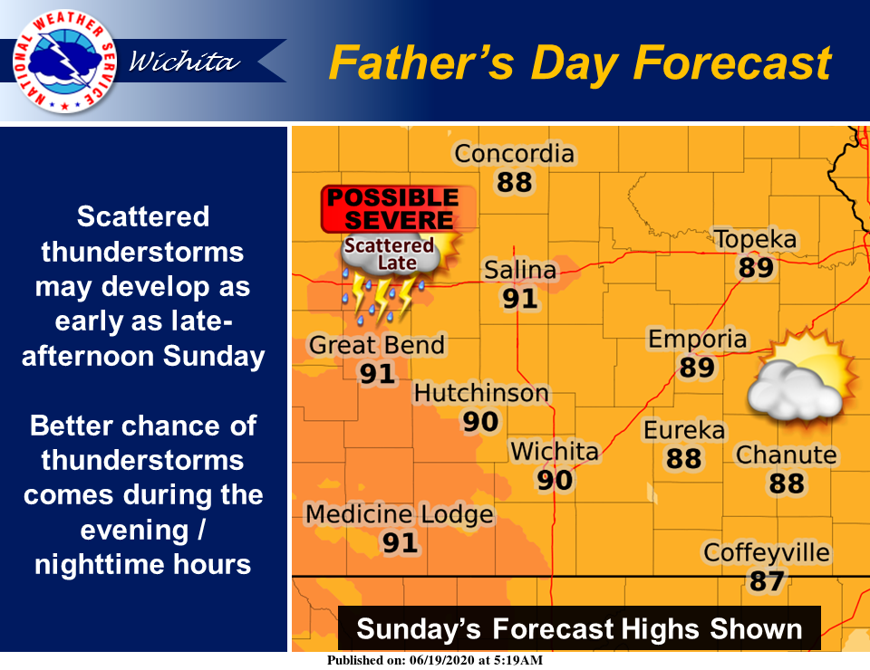
As of now, Father's Day looks to start out dry and very warm. By late in the day, the risk of thunderstorms may increase, especially across central Kansas, NWS reported. By the evening and overnight hours, that risk will expand east into parts of southern and eastern Kansas. Severe weather will be possible with this activity, so stay tuned for updates.