UPDATE 7 p.m. Thursday:
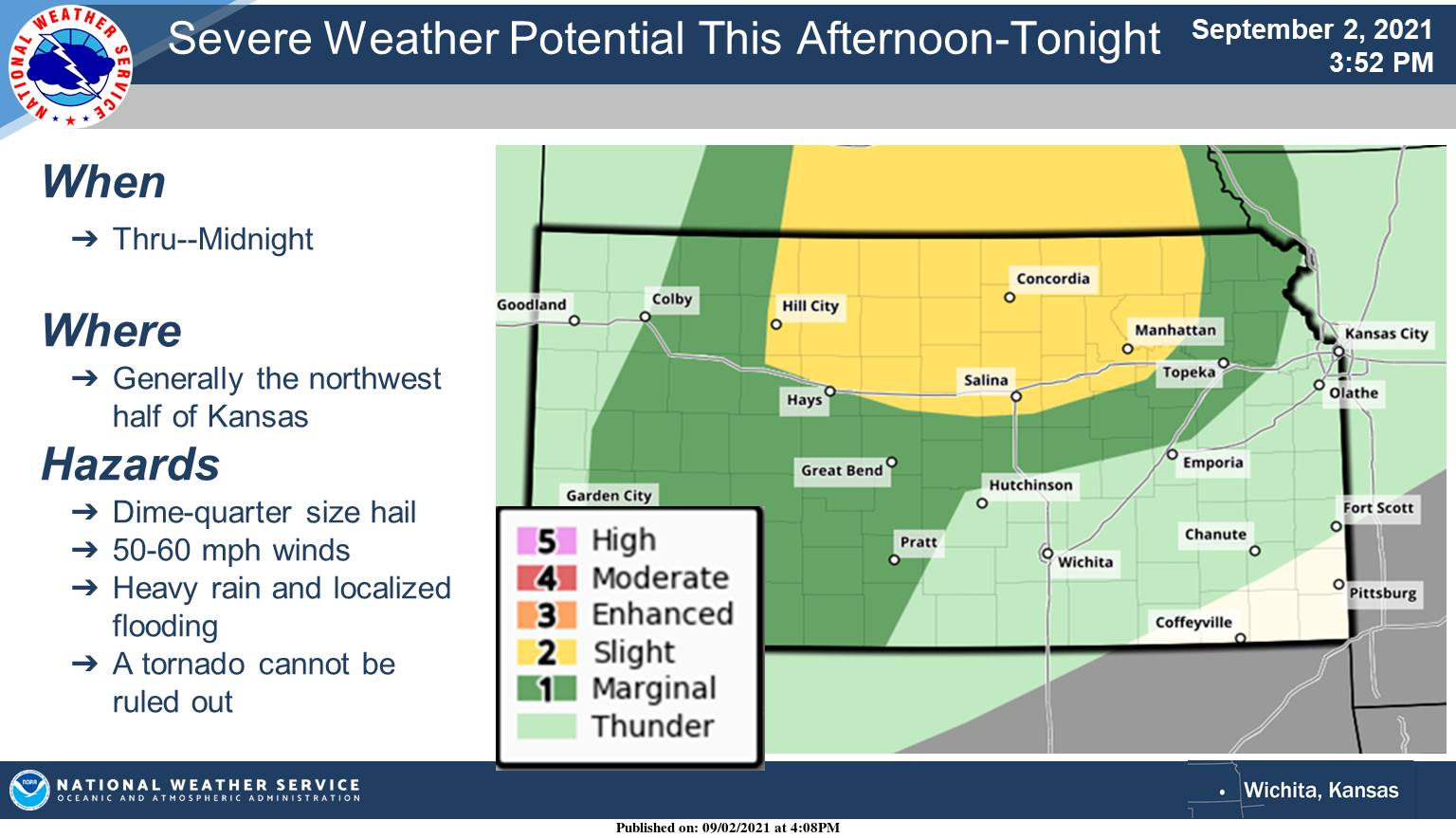
According to the National Weather Service, the strong to severe storm potential will be mainly across central Kansas, mainly north of Highway 50 through tonight.
Dime to quarter size hail, wind gusts of 50 to 60 mph and a tornado cannot be ruled out. Heavy rainfall may also cause localized flooding.
READ: Multiple counties in the area in tornado watch until midnight
. . .
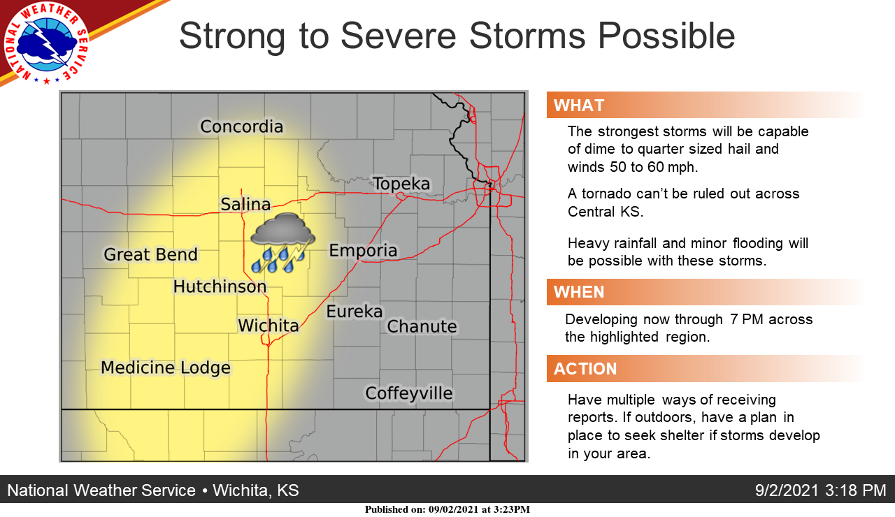
Strong to marginally severe storms will be possible over the next few hours across portions of south-central, and especially central Kansas, according to the National Weather Service.
The main concerns are dime to quarter sized hail and wind gusts of 50 to 60 mph. A tornado can't be ruled out across central Kansas.
Very heavy rainfall will be possible with these storms which may result in minor localized flooding.
To see whether storms are headed your way, check out the radar on the Salina Post severe weather page. Click here.