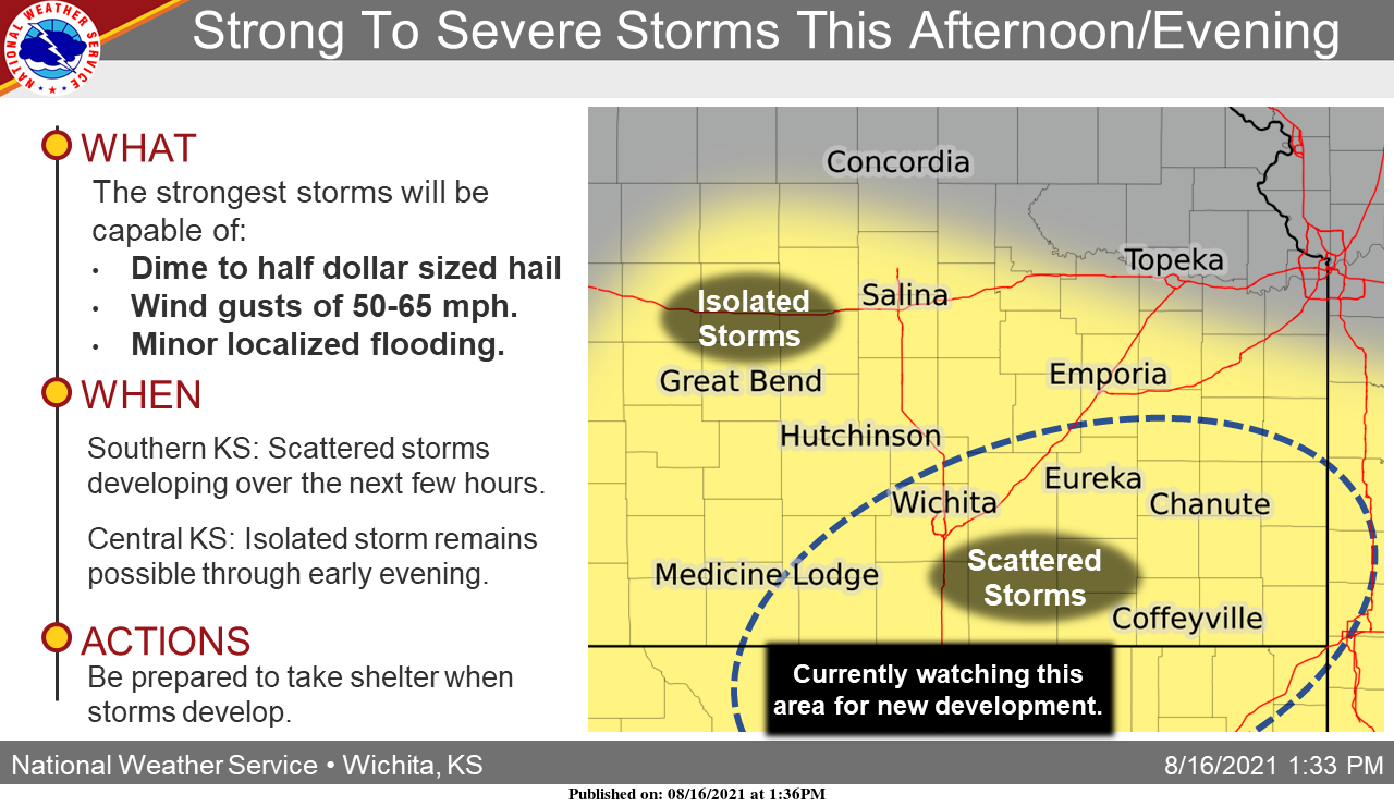
UPDATE 2 p.m. Monday: According to the National Weather Service, afternoon storms will be more isolated across central Kansas and be more scattered across southern Kansas.
The strongest storms will be capable of wind gusts of 50-60 mph and dime to half dollar sized hail. Minor localized flooding will be possible as well given slow storm motions.
. . .
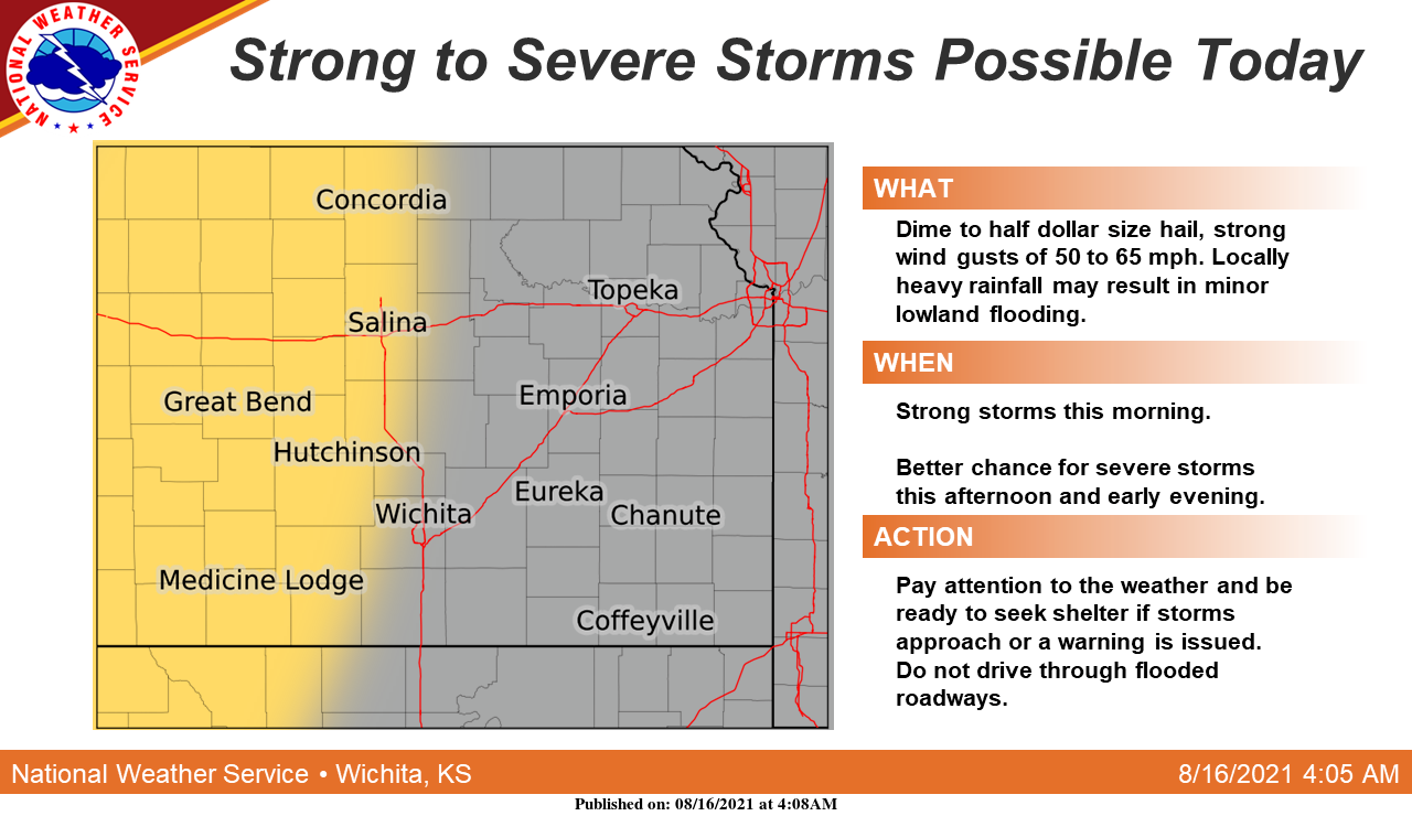
A strong storm is possible this morning across central Kansas with a better chance for strong to severe storms across central and parts of south-central Kansas this afternoon and early evening, according to the National Weather Service.
The main threats will be dime to half dollar size hail, strong wind gusts of 50 to 65 mph and locally heavy rainfall, which may result in minor lowland flooding.
To see whether storms are headed your way, check out the radar on the Salina Post severe weather page. Click here.