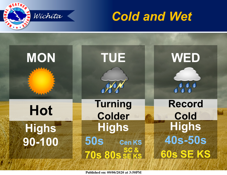
Labor Day will be hot and dry, but don't expect that weather to stick around.
A strong storm system will bring record cold temperatures and wet conditions to the area through the middle of the week, according to the National Weather Service (NWS) in Wichita.
High temperatures may struggle to reach 50 across portions of central and south-central Kansas on Wednesday. Record cold low temperatures are also forecast for much of central and portions of south central Kansas on Wednesday and Thursday mornings, with lows falling into the upper 30s across central Kansas and low to mid 40s over south-central Kansas, NWS reported.
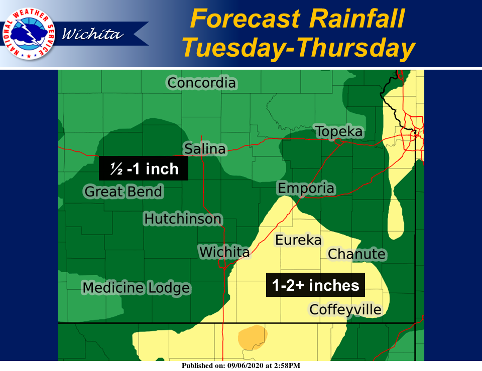
Additionally, a strong early fall storm system will bring periods of showers and storms to the area late Monday night through Thursday. Locally heavy rain is anticipated with widespread 1-2 inches of rainfall across the region, NWS noted. Locally higher amounts will be possible.