While a few storms are possible this morning, look for the threat of severe weather to ramp up this Father's Day afternoon.
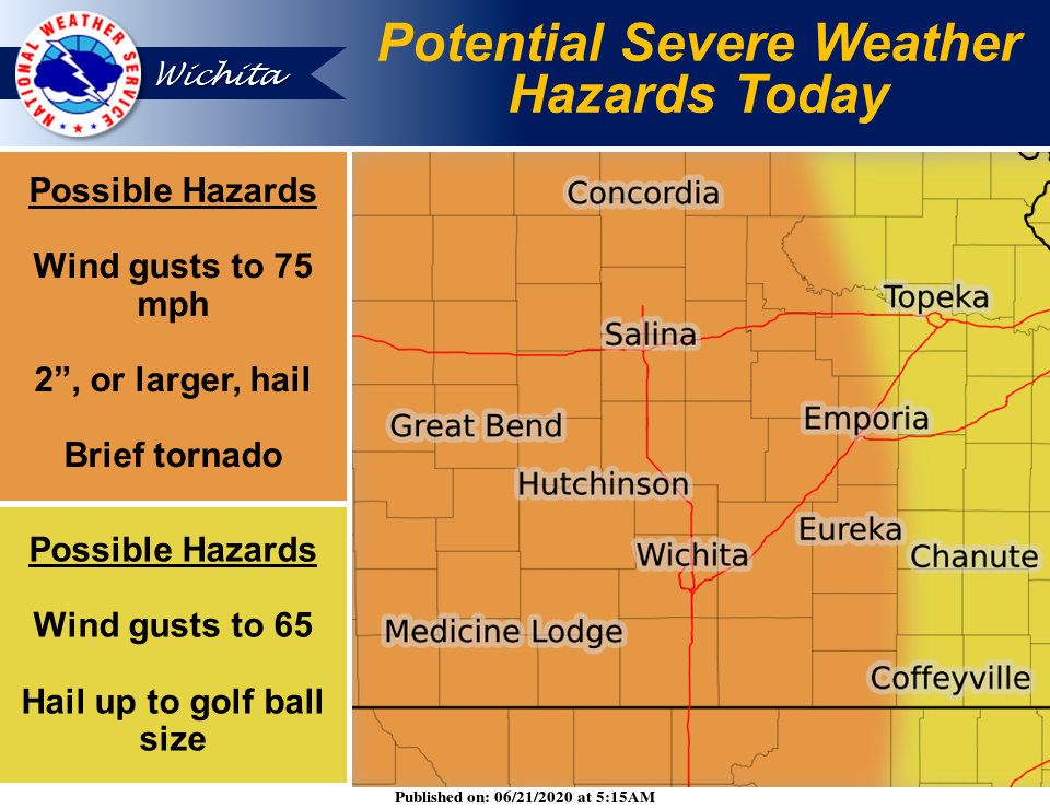
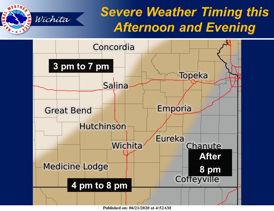
According to the National Weather Service (NWS) in Wichita, the threat of severe weather will increase this afternoon and evening, first across central and south-central Kansas, then potentially reaching southeast Kansas tonight.
The primary hazards will be hail up to baseball size and wind gusts of 60-75 mph. A brief tornado cannot be ruled out, mainly central and south-central Kansas.
Minor river and flash flooding will be possible through tonight, mainly west of Interstate 35.
Additional rounds of thunderstorms, some strong to severe, will be possible Monday and again mid to late week. Minor river flooding may linger into early next week.