From THE NATIONAL WEATHER SERVICE
UPDATE 8:30 p.m. Friday: The National Weather Service has moved Dickinson, Marion, and McPherson counties into winter weather advisory status. Please see below.
. . .
UPDATE 11:55 a.m. Friday: Ellsworth County and Saline County have been added to the winter storm warning list. Please see below.
. . .
Winter storm warnings have replaced the winter storm watches for some counties in our area.
For road conditions, go to kandrive.org or call 5-1-1 or 1-866-511-KDOT (5368).

Winter storm warnings
The National Weather Service in Wichita has issued a winter storm warning in effect from 12 a.m. Saturday to 12 a.m. Sunday for the following counties in our area.
Ellsworth County
Saline County
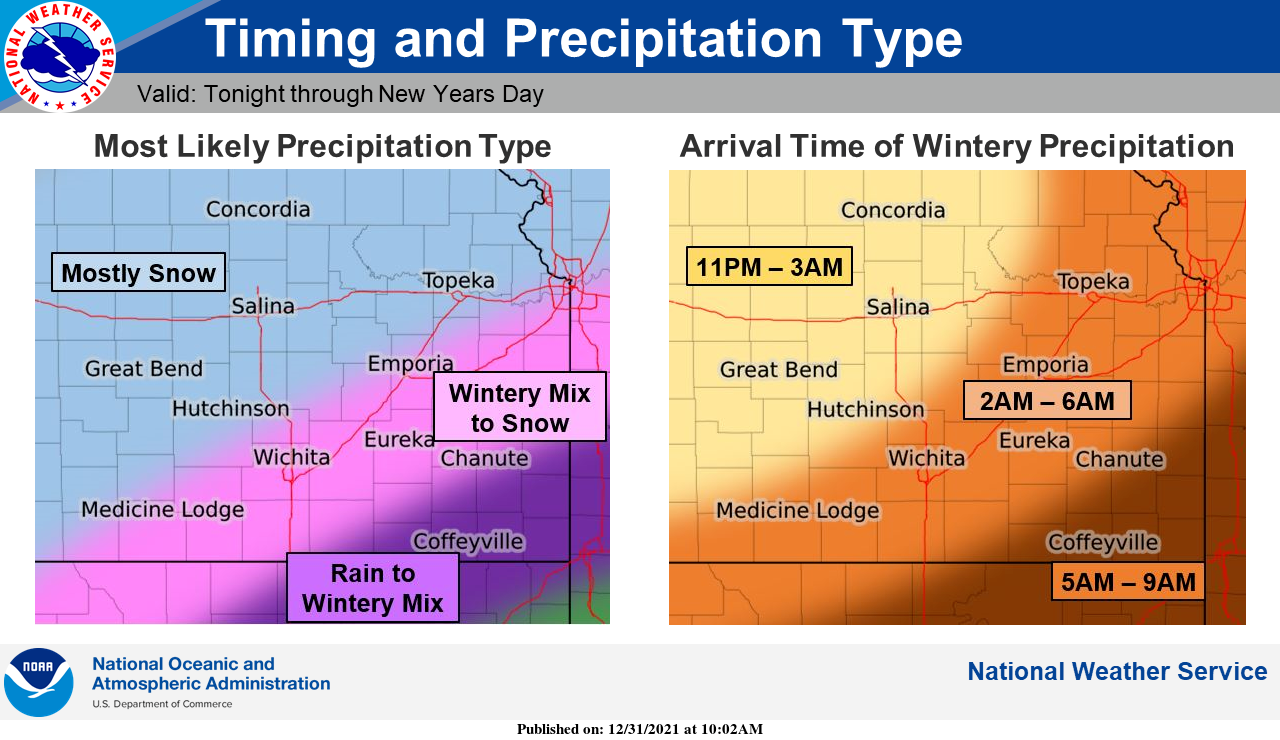
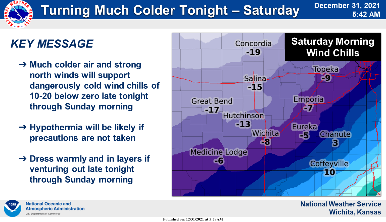
Heavy snow is expected, with total snow accumulations of 3 to 6 inches. Snow may mix with sleet at times, especially near the onset of precipitation and into the predawn hours on Saturday. Also, dangerously cold wind chills down to around 15 degrees below zero at times are forecast.
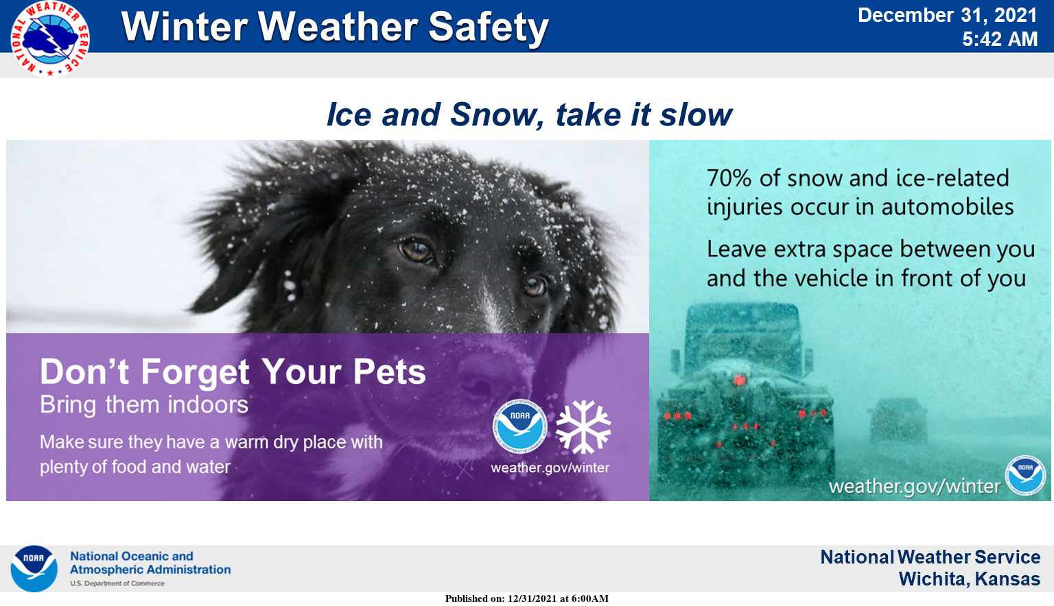
Travel could be very difficult. Areas of blowing snow will significantly reduce visibility at times. Dangerously cold wind chills will result in hypothermia if precautions are not taken.
If you must travel, keep an extra flashlight, food, and water in your vehicle in case of an emergency.
The National Weather Service in Wichita has issued a winter storm warning in effect from 12 a.m. Saturday to 12 a.m. Sunday that includes Lincoln County.
Heavy snow is expected, with total snow accumulations of 5 to 8 inches. Also, dangerously cold wind chills down to around 20 degrees below zero are forecast.
Travel could be very difficult. Widespread blowing snow could significantly reduce visibility. Dangerously cold wind chills will result in hypothermia if precautions are not taken.
If you must travel, keep an extra flashlight, food, and water in your vehicle in case of an emergency.
The National Weather Service in Hastings, Neb., has issued a winter storm warning in effect from 12 a.m. Saturday to 12 a.m. Sunday that includes the following counties in our area.
Jewell County
Mitchell County
Heavy snow is expected, with total snow accumulations of 4 to 8 inches and winds gusting as high as 35 mph.
Travel could be very difficult from. Widespread blowing snow could significantly reduce visibility. Expect areas of drifting snow. The cold wind chills could cause frostbite on exposed skin in as little as 30 minutes.
If you must travel, keep an extra flashlight, food, and water in your vehicle in case of an emergency. Use caution while traveling outside. Wear appropriate clothing, a hat, and gloves.
The National Weather Service in Topeka has issued a winter storm warning in effect from 12 a.m. Saturday to 12 a.m. Sunday that includes the following counties in our area.
Clay County
Cloud County
Ottawa County
Republic County
Heavy snow is expected, with total snow accumulations of 5 to 8 inches and winds gusting as high as 35 mph. Dangerously cold wind chills as low as 20 degrees below zero are expected.
Travel could be very difficult. Areas of blowing snow could significantly reduce visibility. The cold wind chills as low as 20 below zero could cause frostbite on exposed skin in as little as 30 minutes. Very cold wind chills Saturday and Saturday night could be dangerous for vulnerable populations and those that may become stranded in their vehicles.
If you must travel, keep an extra flashlight, food, and water in your vehicle in case of an emergency.
Winter weather advisories
The National Weather Service in Topeka has issued a winter weather advisory in effect from 12 a.m. Saturday to 12 a.m. Sunday that includes Dickinson County.
Snow, sleet, and light freezing rain are expected. Total snow and sleet accumulations of 1 to 5 inches. Light ice accumulations of a few hundredths of an inch are possible. Winds gusting as high as 35 mph are forecast.
Plan on slippery road conditions. Patchy blowing snow could significantly reduce visibility. The cold wind chills as low as 15 below zero could cause frostbite on exposed skin in as little as 30 minutes.
Very cold wind chills Saturday and Saturday night could be dangerous for vulnerable populations and those that may become stranded in their vehicles. Slow down and use caution while traveling.
The National Weather Service in Wichita has issued a winter weather advisory in effect from 12 a.m. Saturday to 12 a.m. Sunday for the following counties in our area.
Marion County
McPherson County
A mix of sleet, freezing rain and snow expected. Total snow accumulations ranging from 1 to 3 inches with ice accumulations of a light glaze are forecast. Winds gusting as high as 35 mph producing winds chills of 10 to 15 below at times are expected.
Travel could be very difficult. Areas of blowing snow could significantly reduce visibility. Dangerously cold wind chills will result in hypothermia if precautions are not taken.
Slow down and use caution while traveling.