UPDATE: NWS has updated the storm forecast map for tonight.
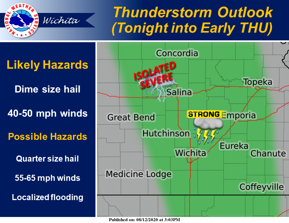
Thunderstorms are expected to redevelop by around midnight and last into early Thursday morning, some of which could be strong, according to the National Weather Service (NWS) in Wichita.
Dime size hail and 40 to 50 mph are the main impacts, NWS reported. An isolated severe thunderstorm may also occur with quarter size hail and 55 to 65 mph winds, NWS added.
There also is a chance for storms again over the weekend, NWS reported.
Additionally, heat indices of 100-105 are possible Friday and Saturday, however, below normal temperatures are possible early next week.