Sunny skies and warmer temperatures are expected to prevail over the next few days.
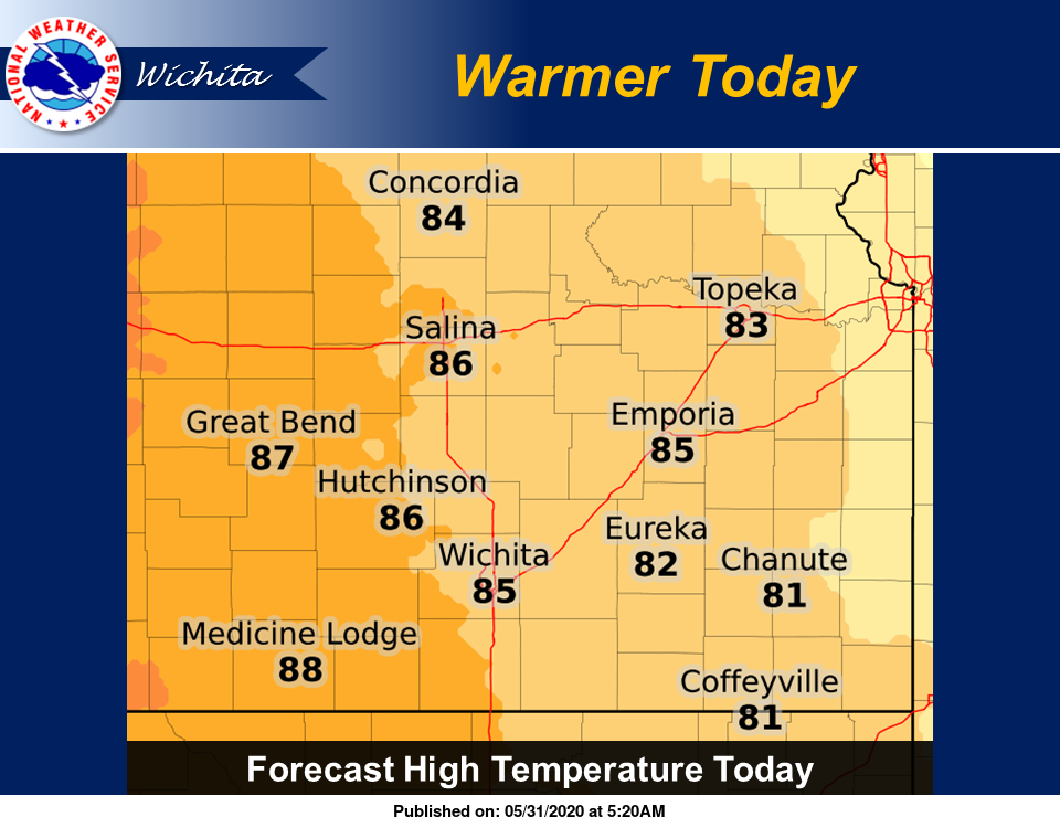
Forecast high temperatures are a bit warmer today across the western half of the area, but similar to Saturday across the east, according to the National Weather Service (NWS) in Wichita. Forecast highs range from near 80 along the Missouri border, to the upper 80s across the middle of the state.
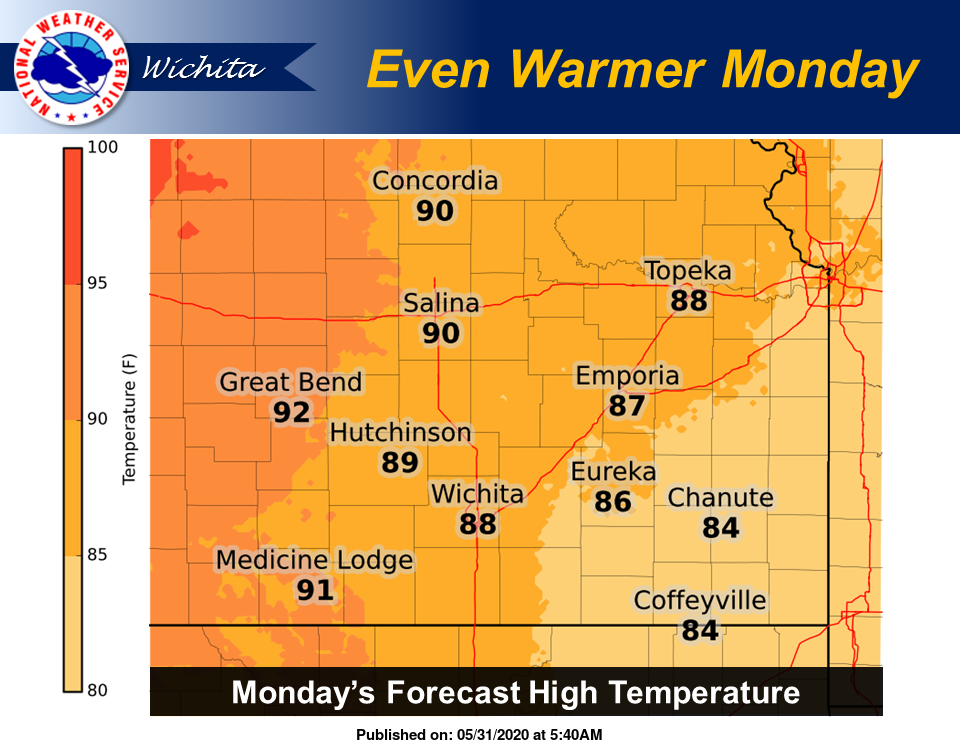
Forecast high temperatures on Monday will be even warmer, ranging from the mid 80s in southeast Kansas to the lower 90s in parts of central Kansas, NWS noted.
There is a slight chance for showers later in the week, but high temperatures will continue in the low to mid 90s range.
Here's the forecast from NWS:
Today
A 20-percent chance of showers before noon. Sunny, with a high near 86. South southeast wind 13 to 18 mph, with gusts as high as 26 mph.
Tonight
Mostly clear, with a low around 65. South southeast wind 13 to 17 mph, with gusts as high as 26 mph.
Monday
Sunny, with a high near 90. Breezy, with a south wind 11 to 16 mph increasing to 18 to 23 mph in the afternoon. Winds could gust as high as 32 mph.
Monday Night
Mostly clear, with a low around 68. Breezy, with a south wind 16 to 21 mph decreasing to 10 to 15 mph after midnight. Winds could gust as high as 30 mph.
Tuesday
Sunny, with a high near 92. South southwest wind 9 to 16 mph, with gusts as high as 24 mph.
Tuesday Night
Mostly clear, with a low around 70.
Wednesday
A 20-percent chance of showers and thunderstorms after 2 p.m. Mostly sunny, with a high near 93.
Wednesday Night
A 20-percent chance of showers and thunderstorms. Partly cloudy, with a low around 66.
Thursday
A 20-percent chance of showers and thunderstorms before 8 a.m. Mostly sunny, with a high near 93.
Thursday Night
Partly cloudy, with a low around 68.
Friday
Sunny, with a high near 94.
Friday Night
Partly cloudy, with a low around 71.
Saturday
Mostly sunny, with a high near 95.