Our weekend looks to include the possibility of rain mixed with sunny skies and seasonal temperatures.
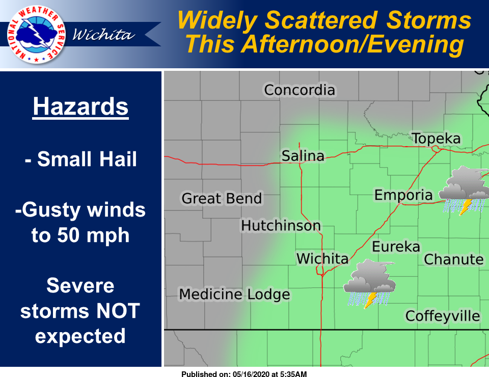
According to the National Weather Service (NWS) in Wichita, widely scattered thunderstorms are expected to develop this afternoon into this evening. A few strong storms with small hail and wind gusts to 50 mph are possible, but widespread severe storms are not expected. High temperatures are expected in the mid- to upper-70s.
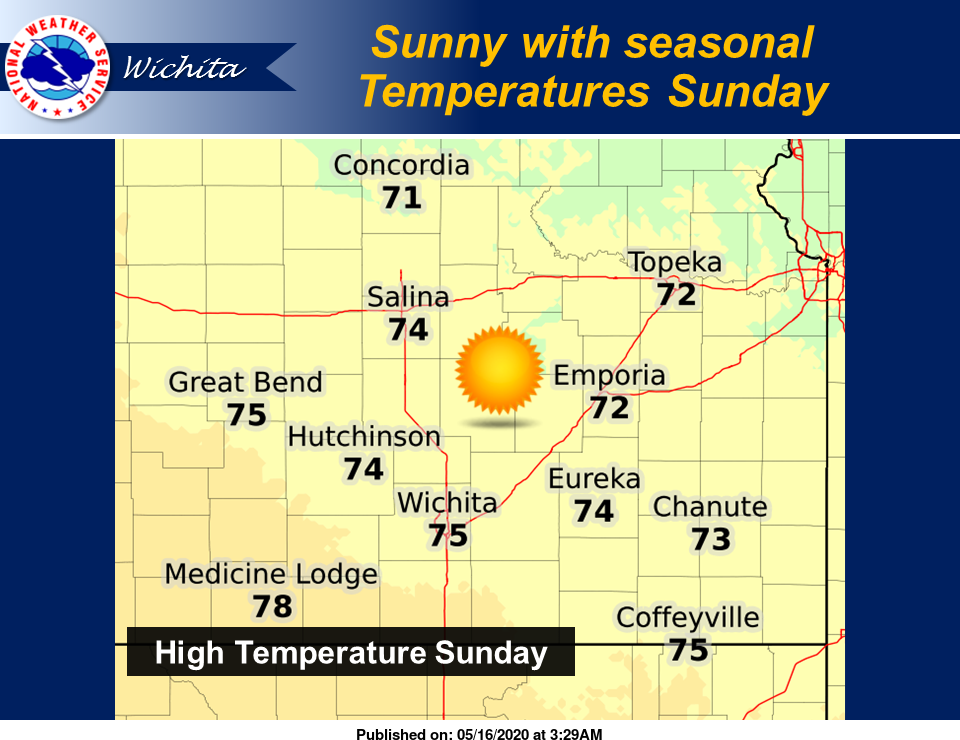
On Sunday, we're expected to see sunny skies and seasonal temperatures with highs in the lower 70s.
That trend is expected to continue through much of next week, with sunny skies and highs in the 70s to lower 80s. A few thunderstorms may move across central Kansas Thursday night, NWS noted, but strong to severe storms are not anticipated at this time.
Here's the forecast from NWS:
Today
A chance of showers, with thunderstorms also possible after 1 p.m. Cloudy, with a high near 78. East wind 6 to 8 mph becoming west in the afternoon. Chance of precipitation is 40 percent.
Tonight
Mostly cloudy, with a low around 51. North wind around 9 mph.
Sunday
Sunny, with a high near 74. North wind 8 to 13 mph, with gusts as high as 18 mph.
Sunday Night
Clear, with a low around 48. North wind 5 to 8 mph becoming calm in the evening.
Monday
Sunny, with a high near 74. Calm wind becoming east northeast around 6 mph in the morning.
Monday Night
Mostly clear, with a low around 50.
Tuesday
Sunny, with a high near 79.
Tuesday Night
Mostly clear, with a low around 55.
Wednesday
Mostly sunny, with a high near 83.
Wednesday Night
Partly cloudy, with a low around 59.
Thursday
Mostly sunny, with a high near 84.
Thursday Night
A 20-percent chance of showers and thunderstorms. Mostly cloudy, with a low around 62.
Friday
Mostly sunny, with a high near 87.