It looks to be a beautiful spring day across much of the area Sunday.
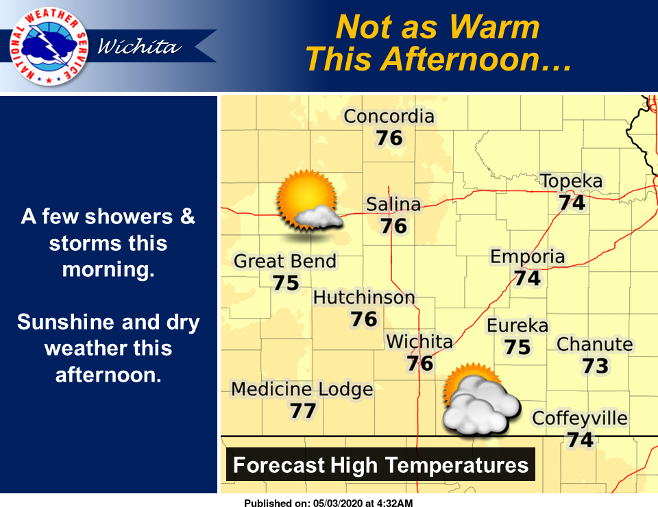
Skies will become partly to mostly sunny this afternoon across central and eastern Kansas, according to the National Weather Service (NWS) in Wichita. While not as warm, it will still be seasonably mild with high temperatures in the 70s, NWS noted.
Here's the NWS forecast for the Salina area from NWS:
Today
A 30-percent chance of showers and thunderstorms, mainly before 8 a.m. Mostly sunny, with a high near 76. North wind 10 to 15 mph becoming east northeast in the afternoon. Winds could gust as high as 21 mph.
Tonight
A 30-percent chance of showers and thunderstorms after 2 a.m. Increasing clouds, with a low around 54. East southeast wind 8 to 11 mph.
Monday
A chance of showers and thunderstorms. Cloudy, with a high near 68. East wind 9 to 11 mph becoming north northeast in the afternoon. Chance of precipitation is 50 percent.
Monday Night
A 30-percent chance of showers before 8 p.m. Mostly cloudy, with a low around 50. North wind 6 to 13 mph.
Tuesday
Mostly sunny, with a high near 74. North northwest wind 3 to 7 mph.
Tuesday Night
Mostly clear, with a low around 48.
Wednesday
Mostly sunny, with a high near 74.
Wednesday Night
A 20-percent chance of showers and thunderstorms after 2 a.m. Mostly clear, with a low around 50.
Thursday
A 20-percent chance of showers and thunderstorms before 2 p.m. Partly sunny, with a high near 73.
Thursday Night
A 30-percent chance of showers and thunderstorms after 8 p.m. Mostly cloudy, with a low around 47.
Friday
A 30-percent chance of showers and thunderstorms. Partly sunny, with a high near 64.
Friday Night
Mostly clear, with a low around 39.
Saturday
Sunny, with a high near 68.