We're going to have a cooler start to the workweek.
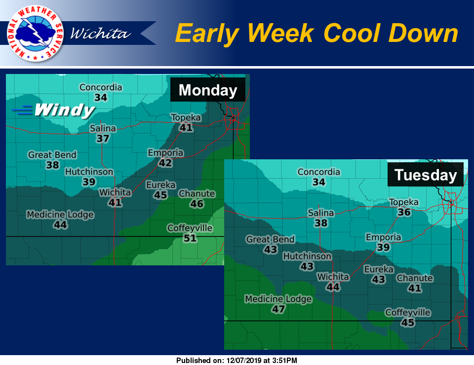
According to the National Weather Service (NWS) in Wichita, a strong cold front will usher in cooler conditions across the region for early this week, with daytime highs in the 30s and 40s.
Strong northwest winds are expected behind the front Monday, which will plummet wind chills into the teens for some on Monday morning.
Here's the forecast for the Salina area from NWS:
Sunday
Increasing clouds, with a high near 56. South southwest wind 5 to 9 mph becoming calm in the afternoon.
Sunday night
Mostly cloudy, with a low around 29. Calm wind becoming north around 5 mph after midnight.
Monday
Scattered flurries before noon. Partly sunny, with a high near 38. Breezy, with a north northwest wind 10 to 15 mph increasing to 21 to 26 mph in the morning. Winds could gust as high as 36 mph.
Monday night
Mostly clear, with a low around 20. North wind 11 to 16 mph becoming light and variable in the evening. Winds could gust as high as 24 mph.
Tuesday
Sunny, with a high near 40.
Tuesday night
Mostly clear, with a low around 20.
Wednesday
Mostly sunny, with a high near 41.
Wednesday night
Mostly cloudy, with a low around 25.
Thursday
Partly sunny, with a high near 46.
Thursday night
Partly cloudy, with a low around 29.
Friday
Partly sunny, with a high near 52.
Friday night
Partly cloudy, with a low around 29.
Saturday
Mostly sunny, with a high near 50.