Snow, rain, wind, and grassland fire danger are still in our immediate future, according to the National Weather Service (NWS) in Wichita.
There's a chance for snow or a wintry mix late Wednesday night. A mix of light snow, sleet or even some freezing rain are possible with little ice accumulation, NWS noted. At this time, central Kansas has the best chance for some light snow accumulations around one inch, mainly for locations along and north of a Kingman to Wichita, to Eureka line, according to NWS.
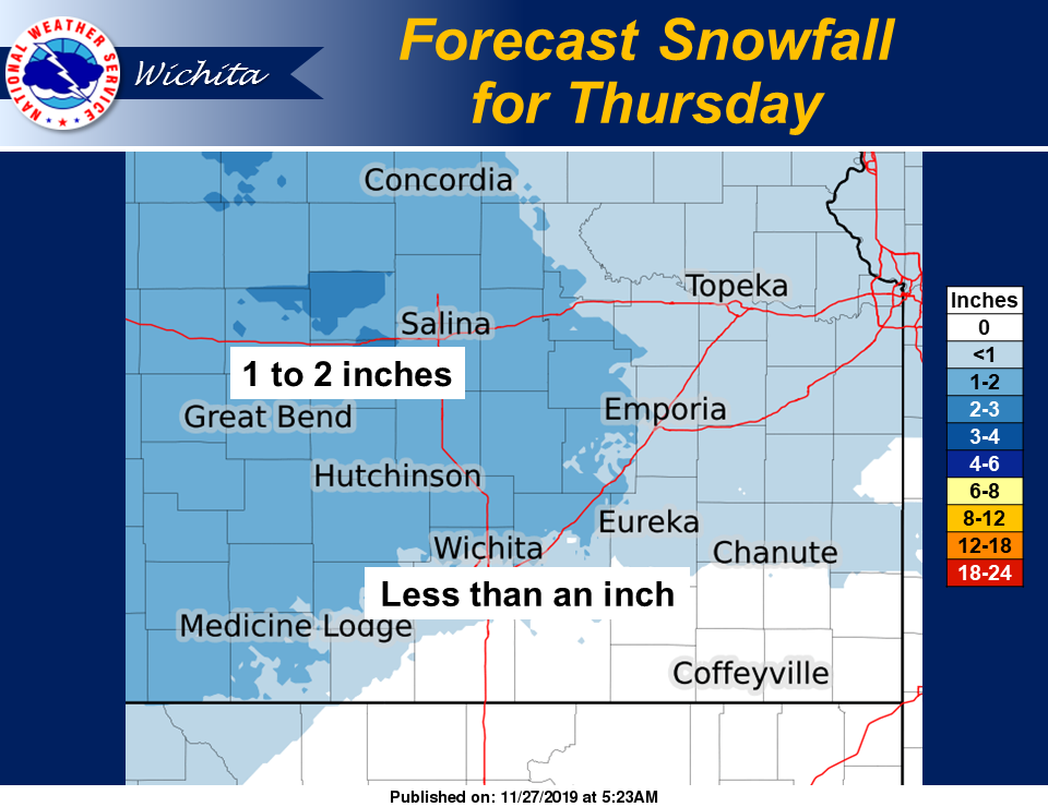
Thanksgiving morning brings with it a chance for light snow or a wintry mix of light snow and sleet with snow changing to rain continuing on Thursday morning. NWS notes that at this time, central Kansas has the best chance for some light snow accumulations, mainly for locations along and north of a Kingman to Wichita, to Eureka line. Total snow accumulations of one to two inches are possible across central Kansas, with less than inch possible in southern Kansas.
Friday, there will be a chance for a few strong to marginally severe thunderstorms and heavy rainfall across the region, according to NWS.
Strong gusty northwest winds will be possible across central Kansas for Saturday afternoon. A very high grassland fire danger is also expected across central Kansas, according to NWS.