Colder air is moving into the area and bringing with it chances for a bit of precipitation.
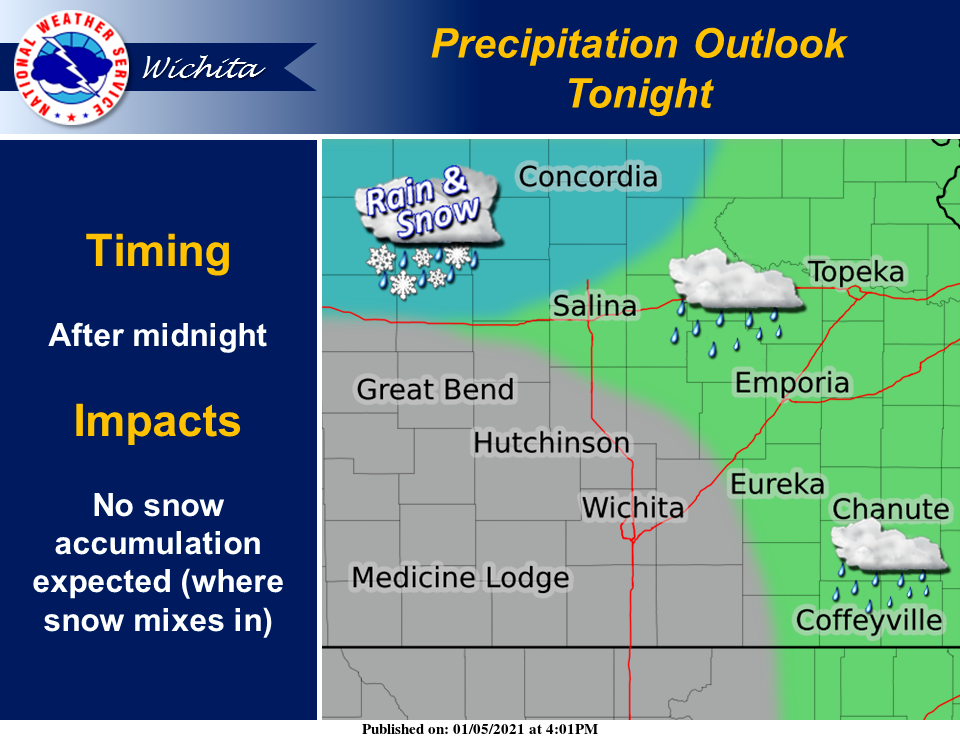
Precipitation may begin to develop across parts of central and eastern Kansas as early as late tonight, according to the National Weather Service in Wichita. The precipitation type will be mostly rain across eastern Kansas, with a rain/snow mix possible across north-central Kansas, however snow accumulation tonight is not expected, NWS noted.
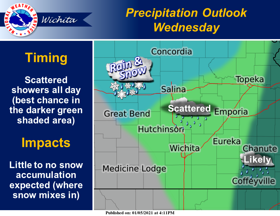
During the day Wednesday, precipitation will begin to spread south and east, impacting more of the area. The best chance of seeing precipitation for much of the day is across far eastern Kansas, with more scattered activity to the west, NWS reported. Where snow mixes in along the Interstate 70 corridor, snow accumulations are expected to be light, if any at all, NWS added.
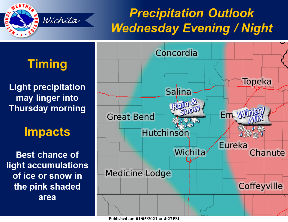
Light precipitation will linger well into Wednesday night, possibly not ending until early Thursday morning. According to NWS, as colder air moves in, the precipitation may begin to mix with, or change to, snow and freezing rain. The best chance of seeing some light accumulations of ice or snow will be across eastern Kansas, NWS explained.
At this time, the impact from wintry weather looks low, NWS reported.