The National Weather Service in Wichita has issued a special weather statement for the following counties in our area.
Ellsworth County
Lincoln County
Marion County
McPherson County
Saline County
The statement is as follows.
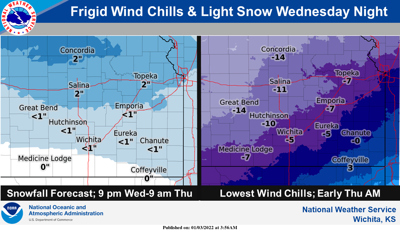
Dangerously cold temperatures will return to the area Wednesday night through Thursday night, with wind chill values falling down into the 5 below zero to 20 below zero range. In addition to the cold temperatures, a quick round of light accumulating snow is likely Wednesday evening through early Thursday morning, with 1 to 3 inches of snow possible. At this time, the greatest risk of seeing accumulating snow, greater than 1 inch, is across northern Kansas, along and north of the Interstate 70 corridor. South of there, a dusting to a half an inch of snow is forecast, with some areas along the Oklahoma Kansas state line not seeing much, if any, snow. These amounts, and the area at greatest risk of accumulating snow, may change, so stay tuned to later forecasts and updates.
Now is a good time to plan ahead for the likelihood of dangerously cold temperatures later this week, and the potential for light snow accumulations.