We're in for some cooler starts, according to the National Weather Service (NWS) in Wichita.
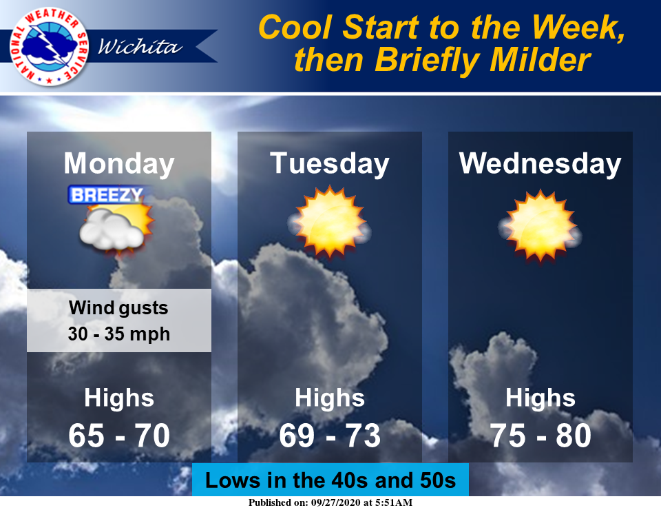
Looking ahead to the upcoming work and school week, temperatures will start on the cooler side, but moderate by mid-week. The cooler temperatures on Monday will be accompanied by breezy conditions and filtered sunshine, NWS noted.
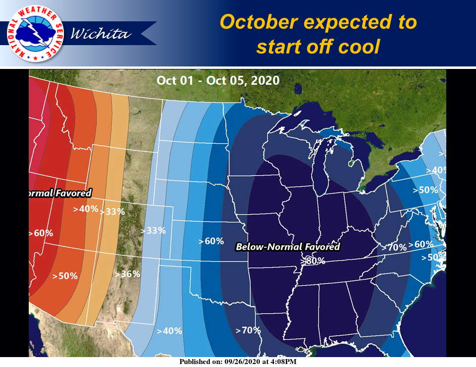
Additionally, below normal temperatures are expected for the start of October, which begins Thursday.
Following is the forecast for the week from NWS.
Today
A chance of rain and thunderstorms before 3 p.m., then a chance of rain between 3 p.m. and 4 p.m. Mostly cloudy, with a high near 70. Breezy, with a north northeast wind 16 to 21 mph, with gusts as high as 36 mph. Chance of precipitation is 30 percent.
Tonight
Partly cloudy, with a low around 47. Southeast wind 10 to 15 mph becoming northwest after midnight. Winds could gust as high as 25 mph.
Monday
Sunny, with a high near 69. Breezy, with a north northwest wind 11 to 21 mph, with gusts as high as 30 mph.
Monday Night
Mostly clear, with a low around 41. North-northwest wind 5 to 9 mph becoming light after midnight.
Tuesday
Sunny, with a high near 73. Light west northwest wind becoming northwest 5 to 9 mph in the morning.
Tuesday Night
Mostly clear, with a low around 49.
Wednesday
Sunny, with a high near 79.
Wednesday Night
Clear, with a low around 45.
Thursday
Sunny, with a high near 67.
Thursday Night
Mostly clear, with a low around 37.
Friday
Mostly sunny, with a high near 64.
Friday Night
Partly cloudy, with a low around 40.
Saturday
Mostly sunny, with a high near 71.