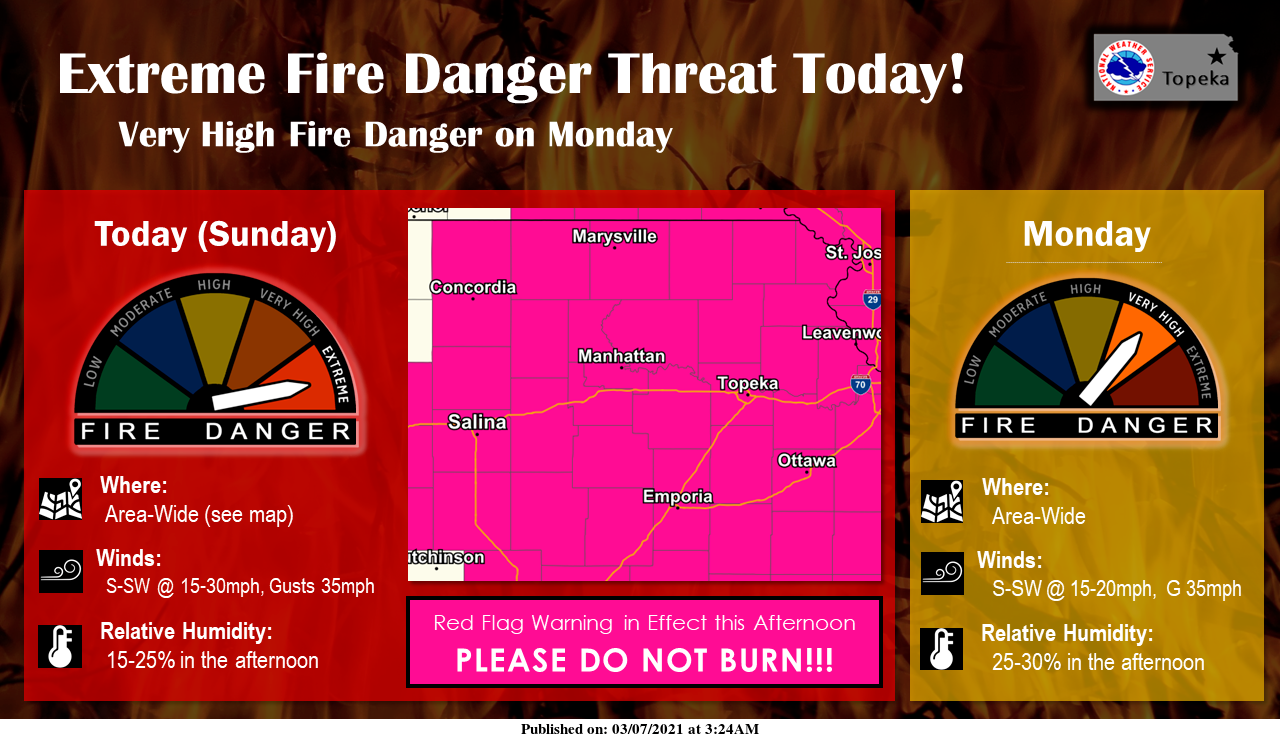
Strong southerly winds and above normal temperatures will result in critical fire weather conditions, prompting the National Weather Service (NWS) to place most counties in our area under red flag warnings for this afternoon and early evening.
Additionally, a very high fire danger is expected over much of the area on Monday, according to NWS in Topeka.
NWS in Wichita has issued a red flag warning in effect from noon to 7 p.m. Sunday for the following counties in our area.
Ellsworth County
Lincoln County
Marion County
McPherson County
Saline County
Extreme grassland fire danger is forecast. Winds out of the south at 20 to 30 mph with gusts up to 40 mph, with relative humidity as low as 25 percent are forecast.
Any fires that develop will likely spread rapidly and become very difficult to control. Outdoor burning is not recommended.
NWS in Topeka has issued a red flag warning in effect from noon to 7 p.m. Sunday for the following counties in our area.
Clay County
Cloud County
Dickinson County
Ottawa County
Republic County
Winds from the south-southwest at 15 to 30 mph with gusts to 35 mph and humidity at 15 to 25 percent are forecast.
Any fires that develop will be very difficult to control and will likely spread rapidly. Burn bans are likely in effect so all outdoor burning should be postponed until conditions improve.