The National Weather Service plans to enhance its severe thunderstorm warnings to include a damage threat tag.
According to information release today, three categories of damage threat have been established for severe thunderstorm warnings. They are as follows.
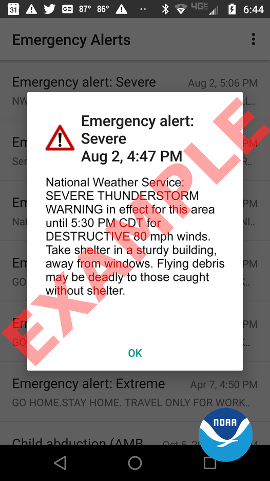
●The criteria for a destructive damage threat is at least 2.75 inch diameter (baseball-sized) hail and/or 80 mph thunderstorm winds. Warnings with this tag will automatically activate a Wireless Emergency Alert (WEA) on smartphones within the warned area.
●The criteria for a considerable damage threat is at least 1.75 inch diameter (golf ball-sized) hail and/or 70 mph thunderstorm winds. This will not activate a WEA.
●The criteria for a baseline or “base” severe thunderstorm warning remains unchanged, 1.00 inch (quarter-sized) hail and/or 58 mph thunderstorm winds. This will not activate a WEA. When no damage threat tag is present, damage is expected to be at the base level.
"On average, only 10 percent of all severe thunderstorms reach the destructive category each year nationwide. Most of these storms are damaging wind events such as derechos and some of the larger, more intense thunderstorms, called 'Supercell' storms that can typically produce very large hail in their path. The new destructive thunderstorm category conveys to the public urgent action is needed, a life-threatening event is occurring and may cause substantial damage to property," the National weather service noted on its website.
The damage threat tags are scheduled to begin on Aug. 2.